|
 Milltown Reservoir Sediments - Milltown, MT Posted by:  T0SHEA T0SHEA
N 46° 52.023 W 113° 52.396
12T E 281022 N 5194398
Milltown, in 1908, was the unfortunate recipient of a gift from the City of Butte, MT, a gift which would, three quarters of a century later, turn out to be a wholly unwelcome one.
Waymark Code: WMMV0A
Location: Montana, United States
Date Posted: 11/05/2014
Views: 4
The contamination at the Milltown site came from quite a distance away and resided at Milltown, in place, for about 73 years before being discovered indirectly. In 1981 routine water quality checks on wells at Milltown revealed them to be contaminated by arsenic and heavy metals. The culprit turned out to be sediments that had washed down the Clark Fork River some 110 miles from Butte in a large flood in 1908, only to be trapped behind a dam that had been built at Milltown to provide hydroelectricity for sawmills in nearby Bonner, MT. The sediments from the flood were contaminated by mining activity at Butte. Heavy metals and other elements in the sediment slowly leached from the sediment into the ground and ultimately into the local aquifers.
In 1983 the site was entered in the National Priorities List for cleanup under Superfund. The contaminated sediment comprised a total of around 2.2 million cubic yards of material. Remediation included the removal of the earth filled dam and began in 2006, being completed on September 24, 2009 with the departure of the final trainload of sediment. Restoration and redevelopment work continue, in part resulting in the creation of a state park.
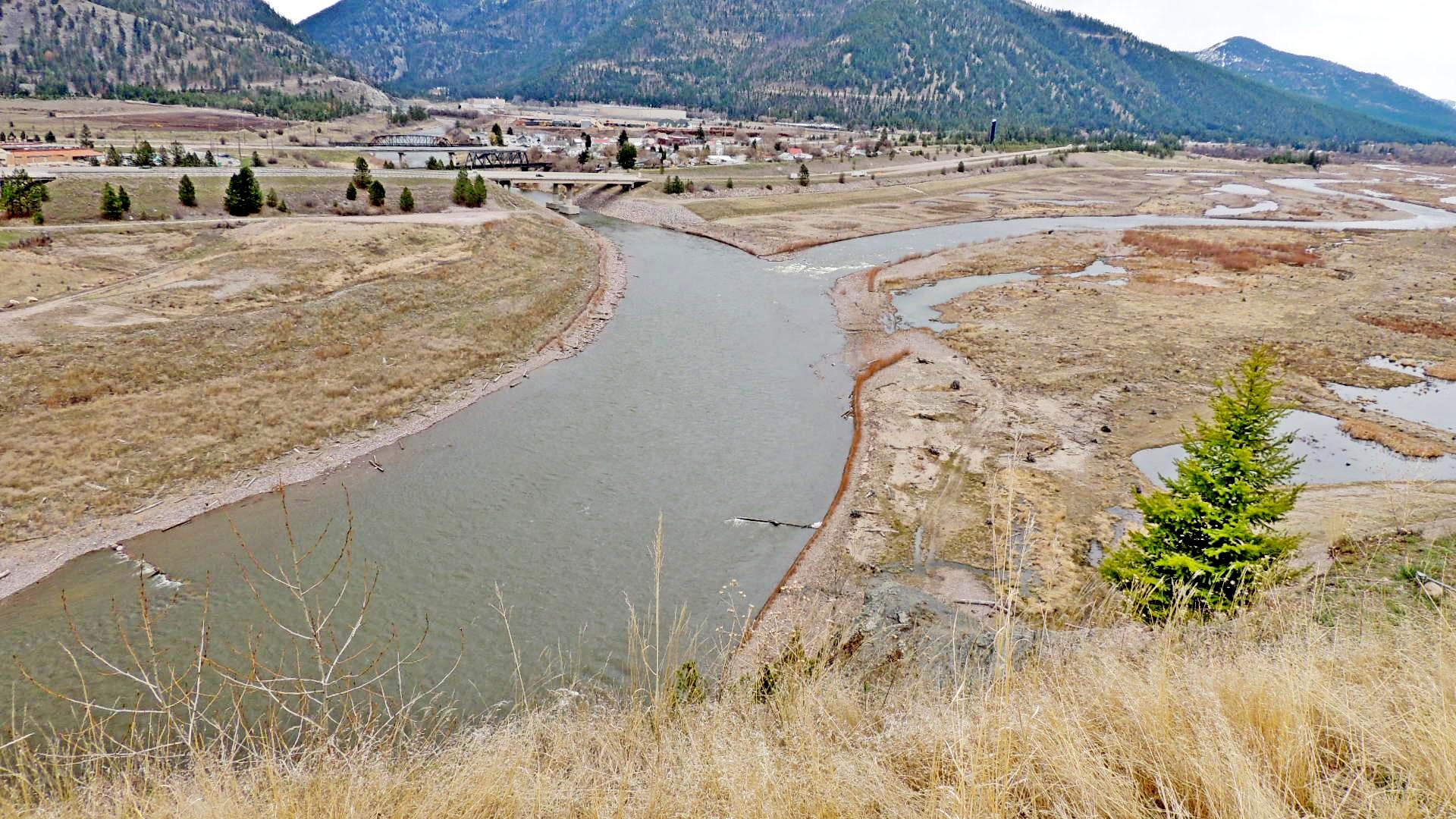 Clark Fork River Cleanup Site at Milltown
ID: MTD980717565

Site Name: Milltown Reservoir Sediments
Link to Site: [Web Link]
Additional Parking: Not Listed
|
Visit Instructions: To post a visit log for waymarks in this category, you must have personally visited the waymark location
Enjoy your visit, tell your story and post a picture.
Recent Visits/Logs:
| There are no logs for this waymark yet. |
|
|
|
|