
Old Men's Provincial Cemetery - Kamloops, BC
Posted by:  T0SHEA
N 50° 40.072 W 120° 19.641
10U E 688861 N 5616299
This cemetery was opened in 1896 for the burial of the first resident of the Provincial Home for Old Men to pass away. The home itself was opened in 1894. This sign (there are actually two, identical) is at the southeast corner of the cemetery.
Waymark Code: WMMFR7
Location: British Columbia, Canada
Date Posted: 09/14/2014
Views: 2
The Old Men's Provincial Cemetery is also known as the 6th Avenue Cemetery or Provincial Cemetery. There are over 1,525 grave sites with the majority are unmarked,.
The first known interments were in 1895.
Old Men's Provincial Cemetery
Address: Corner of 6th Avenue and Douglas Street
There are two sign boards with the same text. I have included the text as follows:
OLD MEN'S PROVINCIAL CEMETERY
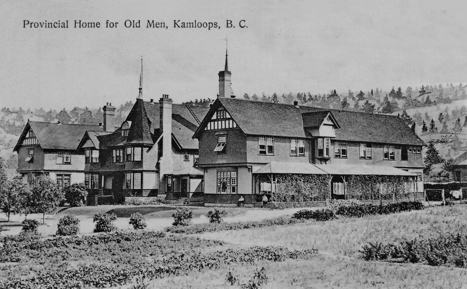
The City of Kamloops incorporated in 1893. Just one year later, it became home to the Provincial Home for Old Men. The Home was built on the farm site belonging to former Government Agent Constable John Ussher who was killed by the Wild McLean Boys twenty years earlier.
The Home was meant to house the old fur trappers, guides and gold miners who opened up the province during the early pioneer years. The first resident arrived in May of 1895. The first recorded death occurred a year later and a special Home Cemetery was opened for the old men on the bench-land above the Provincial Home.
The poor and indigent also shared this cemetery located on the outskirts of town. Most of the over 1,000 graves remain unmarked since Home administrators often had little background information about their old residents. There are written archival records showing the location and name of each burial. Some of the small flat stones which marked individual graves have gradually sunk and lie buried beneath the grass. The last person to be interred in the Old Men's Cemetery died in 1974. By then, the famous old Home had been demolished and a new seniors residence built in its place.
![]()
Group that erected the marker: City of Kamloops

URL of a web site with more information about the history mentioned on the sign: [Web Link]
Address of where the marker is located. Approximate if necessary:
6th Avenue and Douglas Street
Kamloops, BC Canada
|
Visit Instructions:
Take a picture of the marker, preferably including yourself or your GPSr in the photo. A very detailed description of your visit may be substituted for a photo. In any case please provide a description of your visit. A description of only "Visited" or "Saw it while on vacation" by anyone other than the person creating the waymark may be deleted by the waymark owner or the category officers.
Recent Visits/Logs:
| There are no logs for this waymark yet. |
|
|
|