|
 NINTLE - MOOS - CHIN - Vernon, BC Posted by:  T0SHEA T0SHEA
N 50° 15.827 W 119° 16.805
11U E 337496 N 5570447
This BC Heritage Marker is on the south side of a traffic circle at 30th Avenue at 35th Street. It relates how the City of Vernon got its original, intermediate and final names.
Waymark Code: WMMAJ9
Location: British Columbia, Canada
Date Posted: 08/22/2014
Views: 2
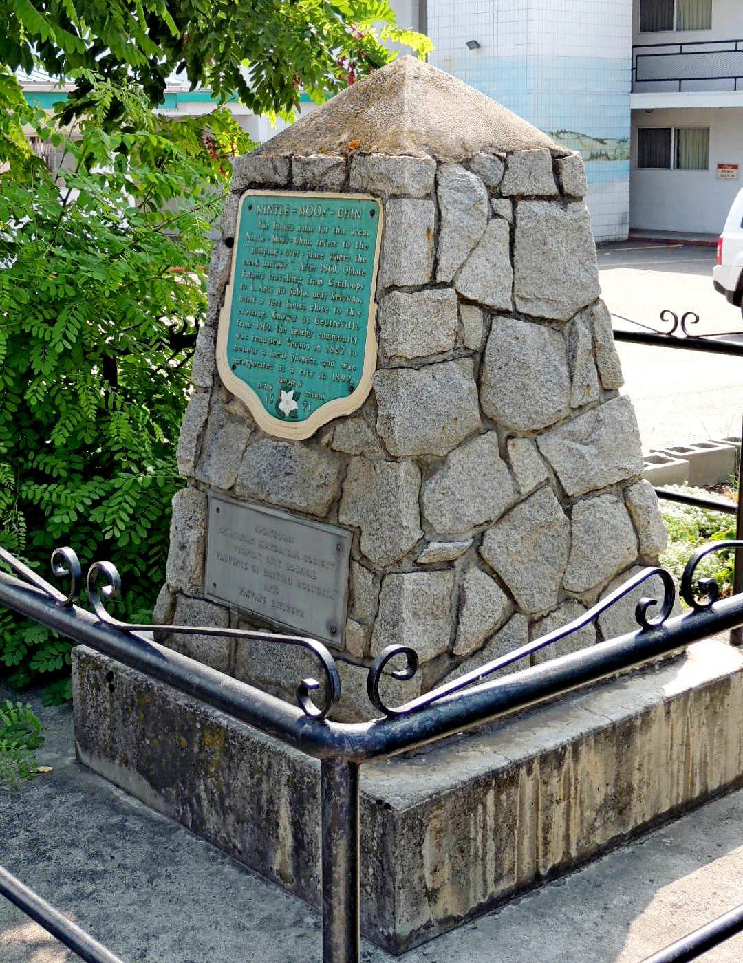
This is a somewhat weathered cairn which has a large BC heritage plaque mounted above a zinc plaque which acknowledges the sponsors of the cairn and signage. The heritage sign is dated 1971.
NINTLE - MOOS - CHIN
The Indian name for this area, Nintle - Moos - Chin, refers to the "jumping over - place where the creek narrows". After 1860, Oblate Fathers travelling from Kamloops to L. Anse au Sable, near Kelowna, built a rest house close to this crossing. Known as Centreville from 1869 the nearby community was renamed Vernon in 1887 to honour a local pioneer, and was incorporated as a city in 1892.
From the Marker
Type of Marker: Cultural

Type of Sign: British Columbia Tourism Sign
Describe the parking that is available nearby: Street parking
What Agency placed the marker?: Province of BC
|
Visit Instructions:
When entering a new log for visiting a waymark please provide a picture of your visit to the location and if you have an interesting alternate area or sign photo include that.
Please include any thoughts or historic information about the area that the marker may represent.
Recent Visits/Logs:
| There are no logs for this waymark yet. |
|
|
|
|