Range Road 225 Truss Bridge - Sharples, AB
Posted by:  T0SHEA
N 51° 28.765 W 113° 03.906
12U E 356598 N 5705162
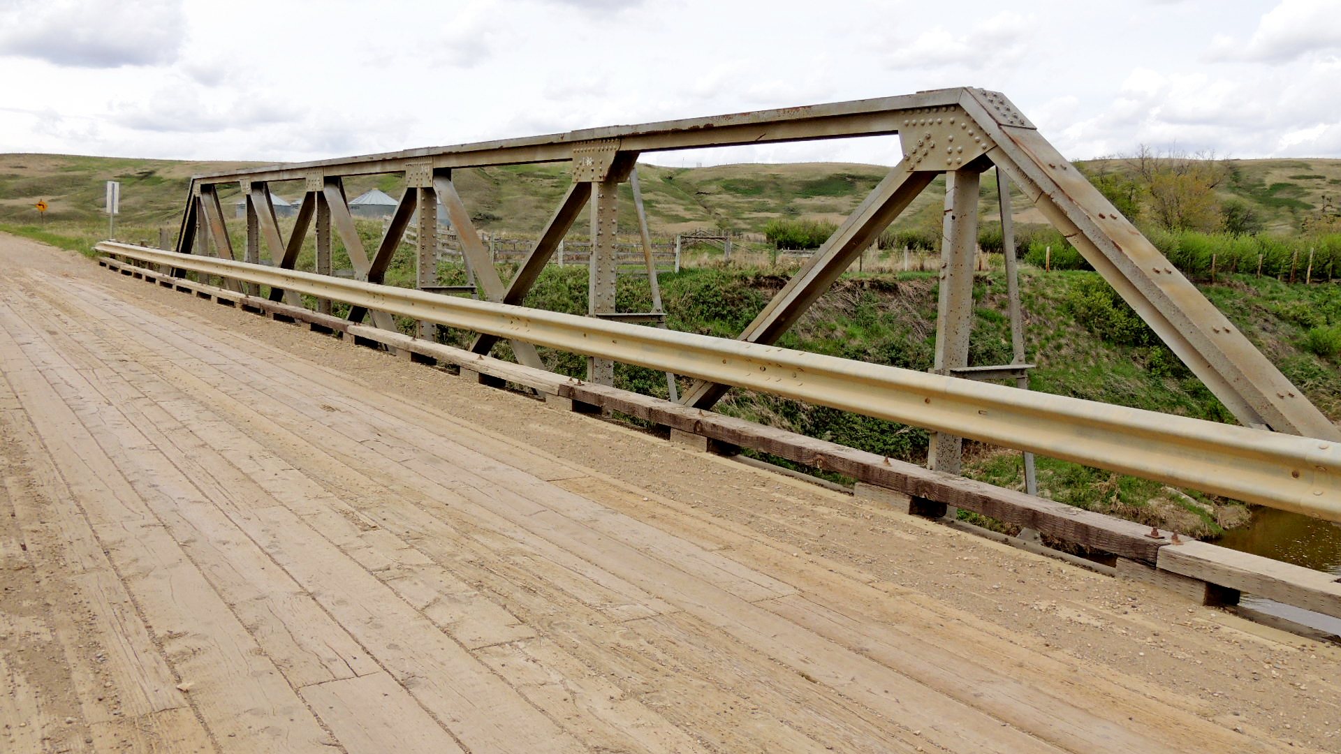
You've doubtless never heard of Sharples, Alberta, or even Carbon, Alberta. Between Carbon and the now ghost town of Sharples are a pair of small wood plank decked truss bridges.
Waymark Code: WMM5D6
Location: Alberta, Canada
Date Posted: 07/24/2014
Views: 1
These bridges are well off the beaten path, this one on Range Road 225, immediately west of the old site of Sharples. Sharples is about 27 km. by road northwest of Drumheller - the place where all the dinosaurs live. The two bridges are similar but not identical, this one being a standard Pratt Through Truss design, the other a modified Pratt Through Truss design. Each is about 75 feet in length. Each bridge crosses Kneehills Creek, which empties into the Red Deer River about 15 km. east, north of Drumheller. One bridge has a plaque that indicates that it may have been built in 1939.
And why was I here, well off the beaten path? Solely to photograph the last remaining elevator in Sharples, a Parrish & Heimbecker elevator built in 1923.