
Devils Lake, Central Oregon
Posted by:  Volcanoguy
N 44° 02.100 W 121° 45.700
10T E 599224 N 4876505
Devils Lake, Deschutes County, Oregon. One of four Devils Lakes in Oregon.
Waymark Code: WMKR
Location: Oregon, United States
Date Posted: 08/27/2005
Views: 33
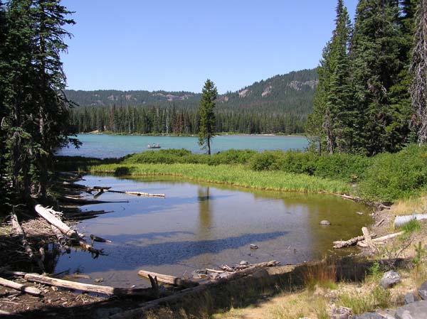
Devils Lake is located in a basin dammed by lava flow from Le Conte Crater about 15,000 years ago. Lake is fed by Tyee Creek and Hell Creek, both of which are spring fed.
To log this waymark, post a photo from somewhere around the lake and the photo location's coordinates.