|
 GS 7/7 - 1000m - Kalvebod Fælled - Amager,Denmark Posted by:  SnowBoat SnowBoat
N 55° 36.289 E 012° 34.520
33U E 347256 N 6164764
Kalvebod Fælled et dejlig natur område der indbyder til ture i det fri, Cykel, løb, Rulleskøjter og lange gåture. Parking : N55 37.080 E012 34.741
Waymark Code: WMJET8
Location: Denmark
Date Posted: 11/09/2013
Views: 8
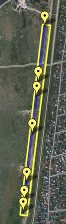
 Den sidste her står 1000m fra Postament #1 (WMJEK6)
Fra 1943 til 1984 blev Vestamager brugt som militært øvelsesområde,
og der blev anlagt skydehøje forskellige steder i området.
Området blev inddæmmet under 2. verdenskrig.
To pumpestationer holder det inddæmmede område tørt.
Siden da er mange planter og dyr indvandret. Mange fugle, især vadefugle,
nyder godt af det fugtige område og den lave vegetation. Den sidste her står 1000m fra Postament #1 (WMJEK6)
Fra 1943 til 1984 blev Vestamager brugt som militært øvelsesområde,
og der blev anlagt skydehøje forskellige steder i området.
Området blev inddæmmet under 2. verdenskrig.
To pumpestationer holder det inddæmmede område tørt.
Siden da er mange planter og dyr indvandret. Mange fugle, især vadefugle,
nyder godt af det fugtige område og den lave vegetation.
 GS-punkterne etableres under af Generalstabens topografiske Afdeling,
der var en Dansk kort myndighed under Generalstablen. Der forsynede
militær og andre civile myndigheder med Topografisk kortdata.
Generalstabens topografiske Afdeling (GS) blev stiftet i 1842,
Afdeling stod for detailmålingen, der dannede grundlaget
for den egentlige kortproduktion indtil 1928 hvor den blev
slået sammen med Den Danske Gradmaaling(GM)
og blev til Geodætisk Institut (GI).
GS-punkterne etableres under af Generalstabens topografiske Afdeling,
der var en Dansk kort myndighed under Generalstablen. Der forsynede
militær og andre civile myndigheder med Topografisk kortdata.
Generalstabens topografiske Afdeling (GS) blev stiftet i 1842,
Afdeling stod for detailmålingen, der dannede grundlaget
for den egentlige kortproduktion indtil 1928 hvor den blev
slået sammen med Den Danske Gradmaaling(GM)
og blev til Geodætisk Institut (GI).
 GS-punkter kan være afmærket med et postament, som vist på her.
Et postament er en granitblok, der er kvadratisk og måler 34*34cm
og er ca. 1 m høj. Under terræn er postamentet støbt ned i
1 kubikmeter beton. Dette er gjort for at sikre, at punktet
ikke flytter sig pga. frost og andre bevægelser i jorden.
I stedet for en granitblok kan et postament være muret op med mursten.
GS-punkter kan være afmærket med et postament, som vist på her.
Et postament er en granitblok, der er kvadratisk og måler 34*34cm
og er ca. 1 m høj. Under terræn er postamentet støbt ned i
1 kubikmeter beton. Dette er gjort for at sikre, at punktet
ikke flytter sig pga. frost og andre bevægelser i jorden.
I stedet for en granitblok kan et postament være muret op med mursten.
  
 ENG.
Pic. 1
This last one is placed 1000m from start Postament #1 (WMJEK6)
From 1943 to 1984, Vestamager used as a military training area,
and here built shooting area in various locations in the area.
The area was dammed in the second World War.
Two pumping stations keep the reclaimed area dry.
Since then, many plants and animals found the way here. Many birds,
especially waterfowl, enjoy the damp area and the low vegetation
Pic. 2
GS points established under the General Staff topographic Department
there was a Danish map authority under General stack. The supplied
military and other civilian authorities Topographic map data.
General Staff topographic Department (GS) was founded in 1842,
Department was responsible for retail measurement that formed the basis
for the actual maps production until 1928 when it was
merged with the Danish Gradmaaling (GM)
and became Geodetic Institute (GI).
Pic. 3
Many GS-points are marked with a postament, as shown here.
A postament is a granite block that is square and measures 34 * 34cm
and is approx. 1 m high. Under the terrain is postamentet cast into the
1 cubic meter of concrete. This is done to ensure that the point
does not move due to frost and other movements in the soil.
Instead of a granite block, a postament can be made by bricks.
ENG.
Pic. 1
This last one is placed 1000m from start Postament #1 (WMJEK6)
From 1943 to 1984, Vestamager used as a military training area,
and here built shooting area in various locations in the area.
The area was dammed in the second World War.
Two pumping stations keep the reclaimed area dry.
Since then, many plants and animals found the way here. Many birds,
especially waterfowl, enjoy the damp area and the low vegetation
Pic. 2
GS points established under the General Staff topographic Department
there was a Danish map authority under General stack. The supplied
military and other civilian authorities Topographic map data.
General Staff topographic Department (GS) was founded in 1842,
Department was responsible for retail measurement that formed the basis
for the actual maps production until 1928 when it was
merged with the Danish Gradmaaling (GM)
and became Geodetic Institute (GI).
Pic. 3
Many GS-points are marked with a postament, as shown here.
A postament is a granite block that is square and measures 34 * 34cm
and is approx. 1 m high. Under the terrain is postamentet cast into the
1 cubic meter of concrete. This is done to ensure that the point
does not move due to frost and other movements in the soil.
Instead of a granite block, a postament can be made by bricks.
Fixpoint type: Postament / Stone

Altitude / Højde: -1
Year/År: 1920
|
Visit Instructions:English:
To log a visit of waymark in this category, you have to post a photo where the point and eventually your GPS is visible.
Also you have to post the coordinates and the height, you see on your GPS.
Dansk:
For at logge et besøg på et waymark i denne kategori, skal du poste et foto, hvor fixpunktet og gerne din GPS er synlig.
I loggen skal du skrive koordinater og højdeaflæsning fra din GPS.
Recent Visits/Logs:
| There are no logs for this waymark yet. |
|
|
|
|