|
 Velky Inovec - Pohronsky Inovec, Slovakia Posted by:  Rikitan Rikitan
N 48° 24.594 E 018° 32.617
34U E 318227 N 5364775
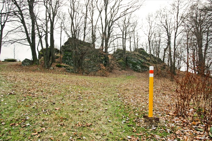
Velky Inovec (901 metres / 2956 feet ASL) is highest hill of volcanic mountains called Pohronsky Inovec in central Slovakia.
Waymark Code: WMJDDT
Location: Banskobystrický kraj, Slovakia
Date Posted: 11/03/2013
Views: 18

 Velky Inovec
 is highest hill (901 metres / 2956 feet ASL) in Pohronsky Inovec mountains, central Slovakia.
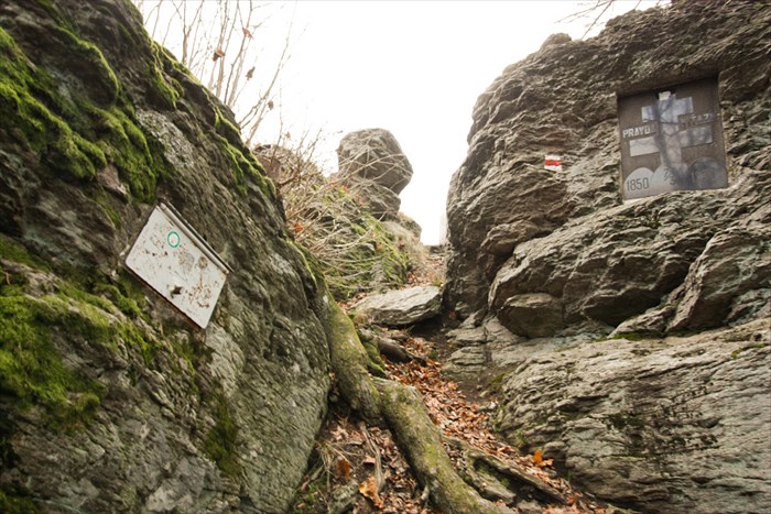
Its rocky summit is located in central part of volcanic mountains with view limited to south and west only.
There's a cottage 10 minutes of walk under the top of Inovec, open to public on weekends and holidays (in July and August daily).
Routes:
Velky Inovec can be reached basicly from any side - at least as many as 9 different starting points, following marked hiking trails, here are the most popular ones:
- red trail: Zlate Moravce - Velky Inovec, 15.5km, 922m up, 206m down, time: 4:55
- green trail: Motorest Zubor - Velky Inovec - Stara Huta, 16.4km, 761m up, 566m down, time: 5:05
- yellow trail: Osná dolina - Velky Inovec - Tekovské Nemce, 16.8km, 611m up, 686m down, time: 4:55
- blue trail: Topolcianky - Velky Inovec - Mala Lehota, 25.3km, 1155m up, 830m down, time: 7:50
View slovak hiking map will help you to plan your trip here.

 Velký Inovec (901m.n.m.)
 je vrch na Slovensku v pohorí Pohronský Inovec. Je to najvyssí vrch celého pohoria, situovany v jeho centralnej casti.
Od roku 1992 je vrchol prírodnou pamiatkou. Tvorí ho bralnatý relikt andezitového prúdu a je z neho obmedzený výhlad.
Pod vrcholom sa nachádza turistická chata na Velkom Inovci, otvorená cez víkendy a sviatky a v mesiacoch júl a august nepretrzite.
Plosina pred chatou ponúka výborný výhlad na región Tekova, zvlnenú Pohronskú pahorkatinu s obcami, hájmi, polami a rieku Hron.
Pristup:
Dostanete sa sem prakticky z ktorejkolvek strany, staci si vybrat z mnohych znacenych turistickych tras:
- cervena: Zlate Moravce - Velky Inovec, 15.5km, 922m hore, 206m dole, cas: 4:55
- zelena: Motorest Zubor - Velky Inovec - Stara Huta, 16.4km, 761m hore, 566m dole, cas: 5:05
- zlta: Osná dolina - Velky Inovec - Tekovské Nemce, 16.8km, 611m hore, 686m dole, cas: 4:55
- modra: Topolcianky - Velky Inovec - Mala Lehota, 25.3km, 1155m hore, 830m dole, cas: 7:50
Pozrite si turisticku mapu oblasti pre planovanie vasej tury.
Altitude in Feet: 2956

|
Visit Instructions:
To post a visit log for waymarks in this category, you must have personally visited the waymark location. When logging your visit, please provide a note describing your visit experience, along with any additional information about the waymark or the surrounding area that you think others may find interesting.
We especially encourage you to include any pictures that you took during your visit to the waymark.
|