
Mel DeAnna Trail Viewpoint - Highway 3 Rest Area, Castlegar, BC
Posted by:  T0SHEA
N 49° 14.891 W 117° 38.319
11U E 453520 N 5455241
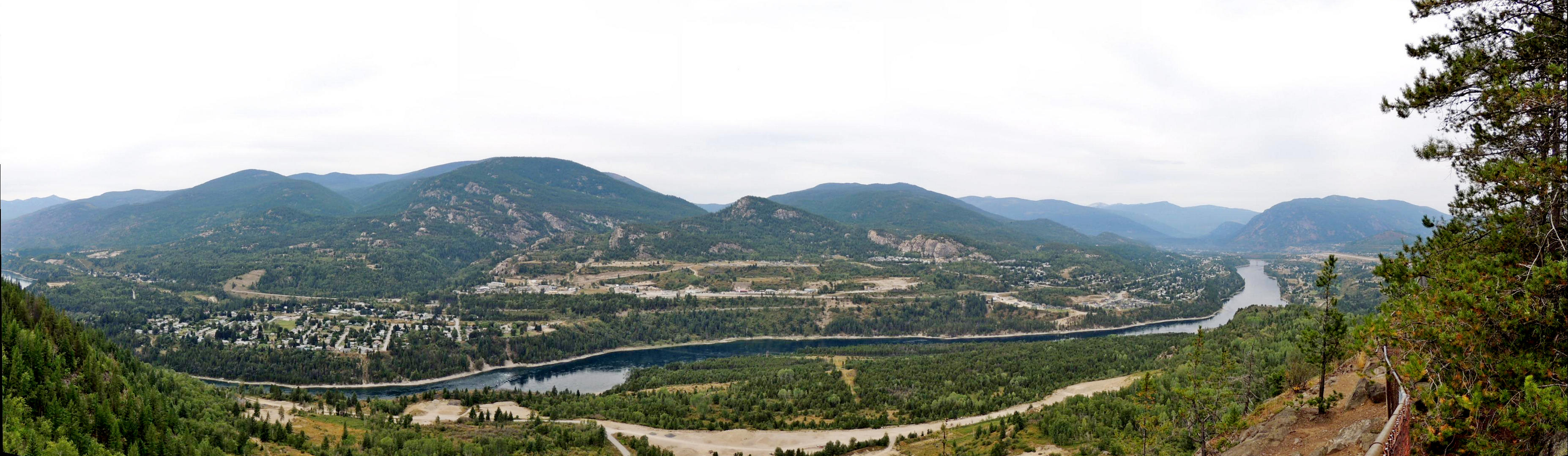
This viewpoint is at a rest area 5.8 km. down Highway 3 from the interchange by the Castlegar airport.
Waymark Code: WMHZ37
Location: British Columbia, Canada
Date Posted: 08/30/2013
Views: 8
At the rest area is the Mel DeAnna Memorial Hiking Trail, a 5 km loop which is fairly well shaded and affords many opportunities for both birdwatching and viewing the Columbia River Valley. Elevated well above the valley floor, it has an excellent view up and down the valley.
From the signage:
Mel DeAnna
Difficulty Level: Easy/Intermediate
Distance: 5Km loop
Gain: Om
Season: Year-round
A level shaded walk that loops around Champion Ponds. This is a great trail for birdwatchers with many opportunities to stop and enjoy the view of the Columbia River valley. The Poplar and Larch trees make this a spectacular hike in the fall. Thanksgiving meals can enjoyably be walked off by the whole family on this beautiful loop trail. Once the snow arrives this trail is a popular snowshoe loop. At the 1.5km mark on the trail, there is a junction. This is a 2 km loop so it doesn't matter which way you go.
The Mel Deanna Trail was created through a joint project of the West Kootenay Naturalists, Castlegar and District Wildlife Association, Selkirk College, and the Ministry of Forests. Castlegar Friends of Parks and Trails Society assists with trail maintenance and promotion. Please exercise caution above the numerous cliffs along this trail.