
Weed Southbound Rest Area Orientation Table - Siskiyou County, CA
N 41° 28.663 W 122° 27.400
10T E 545363 N 4591933
This interpretive display is located within the Weed Rest Area on the west side of Interstate-5 heading south in Siskiyou County, CA.
Waymark Code: WMH1HN
Location: California, United States
Date Posted: 05/06/2013
Views: 4
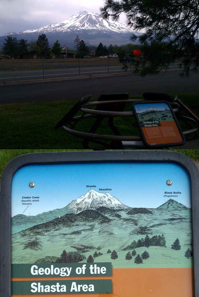
The Weed Southbound Rest Area is located just off Interstate-5. This rest area contains an interpretive display highlighting the flora and local geological areas of significance. One of the displays contains an orientation table of Mt Shasta and surrounding cinder cones and reads:
Geology of the Shasta Area
Much of the landscape around you has been sculpted by volcanic activity. The hills of the western half of the Shasta Valley are actually older, eroded volcanoes. Among these hills are lava mesas, or plateaus, formed by lava flows from the older volcanoes. The eastern half of the valley has been shaped by huge lava flows from Mt. Shasta.
Mt. Shasta, towering directly ahead, appears to be more or less a single cone. From the north or south, however, one can clearly see Shastina, a smaller cone about 1.5 miles west of the main crater. In fact, some geologists believe that Mt. Shasta is actually four overlapping volcanoes of varying ages.
Black Butte, seen south of Mt. Shasta, was formed by a single mass of thick lava that was pushed through an existing volcanic crater. The resulting steep-sided hill is called a plug dome.
The view of Mt. Shasta is spectacular. This mountain makes quite a statement from just about any location within 30 miles and at some places, even much further.