Oregon State Capitol Building - Salem, Oregon
Posted by:  ddtfamily
N 44° 56.541 W 123° 01.709
10T E 497752 N 4976546
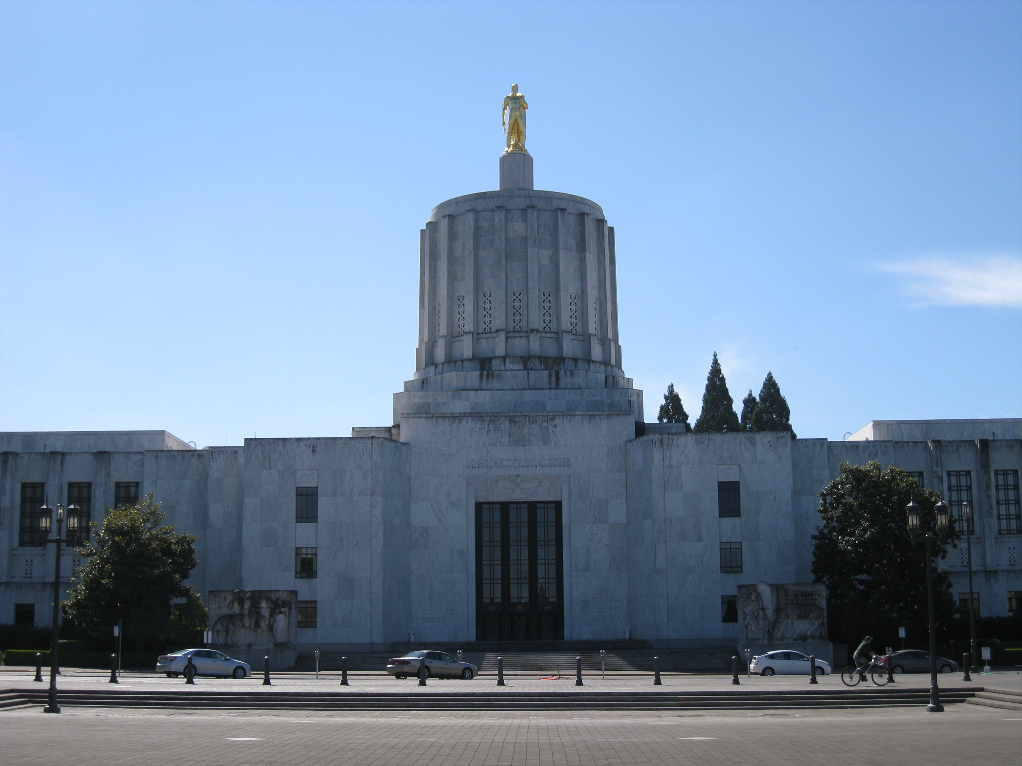
A memorable U.S. 99E landmark: Oregon's Art Deco Capitol Building
Waymark Code: WMGYTH
Location: Oregon, United States
Date Posted: 04/24/2013
Views: 10
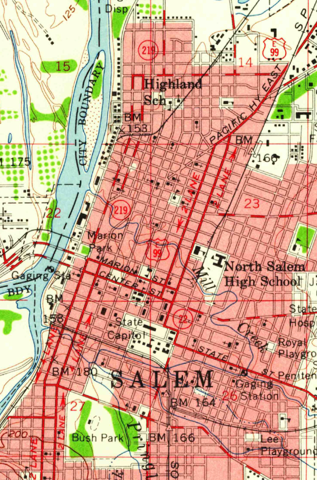
Oregon's portion of U.S. Highway 99 split into two separate routes north of Junction City: US-99W, which crossed through the western side of the Willamette Valley and US-99E (also known as Pacific Highway East) which ran through the eastern side of the valley, through Oregon's capitol city, Salem. In Salem - southbound traveler would have followed Portland Road into the couplet of Summer/Capitol Streets directly toward the Oregon State Capitol Building before turning onto the Marion/Center Street couplet, and finally, onto the Commercial/Liberty street couplet to continue south. The 1957 map segment below shows the route.
Travelers arriving in Salem from the north would have remembered the route down Summer Street, with Oregon's art deco-style capitol building visible straight ahead. Completed in 1938, this is the nation's fourth newest capitol building - the previous, Renaissance-style building was lost due to fire in 1935. In addition to the building's art deco lines, the most notable feature is the 22-foot tall gold pioneer, which tops the cupola.
Following the building of Interstate 5 east of downtown Salem, U.S. Highway 99E was decommissioned. Modern Oregon Route 99E through Salem was moved to overlap the route of I-5 until the Portland Road interchange, where it again splits off toward Woodburn and Oregon City over the original route of US-99E.
Note: GPS Coordinates are from the intersection of Summer and Marion Streets, the last point where the Capitol was visible before turning east.
Click a photo to enlarge