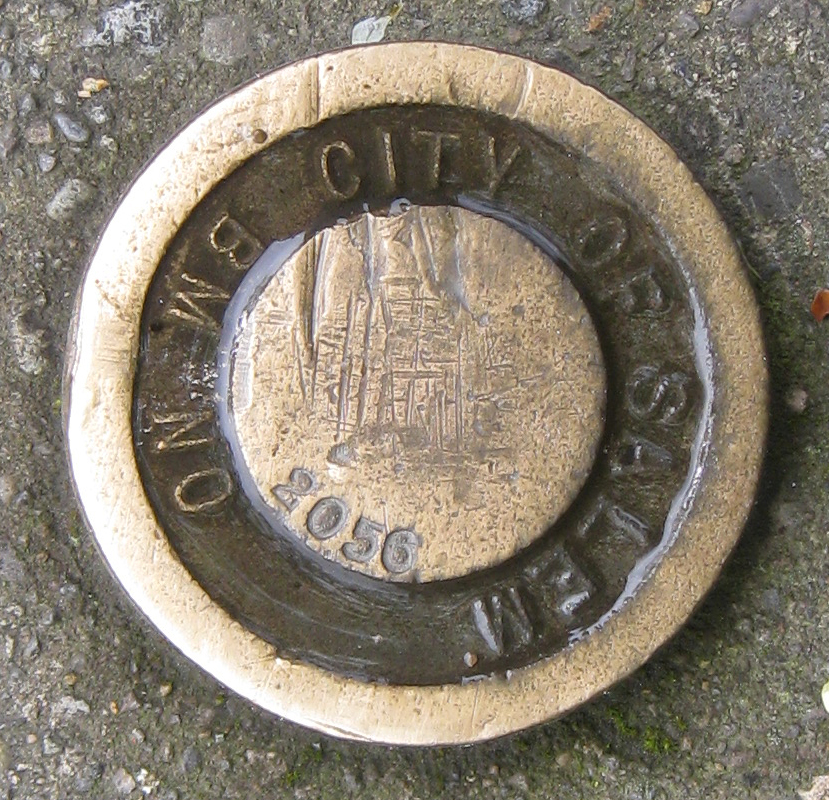
City of Salem Benchmark #2056 - Salem, Oregon
Posted by: Groundspeak Regular Member ddtfamily
N 44° 55.957 W 123° 01.762
10T E 497682 N 4975465
City of Salem Survey Control Benchmark #2056
Waymark Code: WMGT2Z
Location: Oregon, United States
Date Posted: 04/07/2013
Published By:Groundspeak Premium Member Ernmark
Views: 3

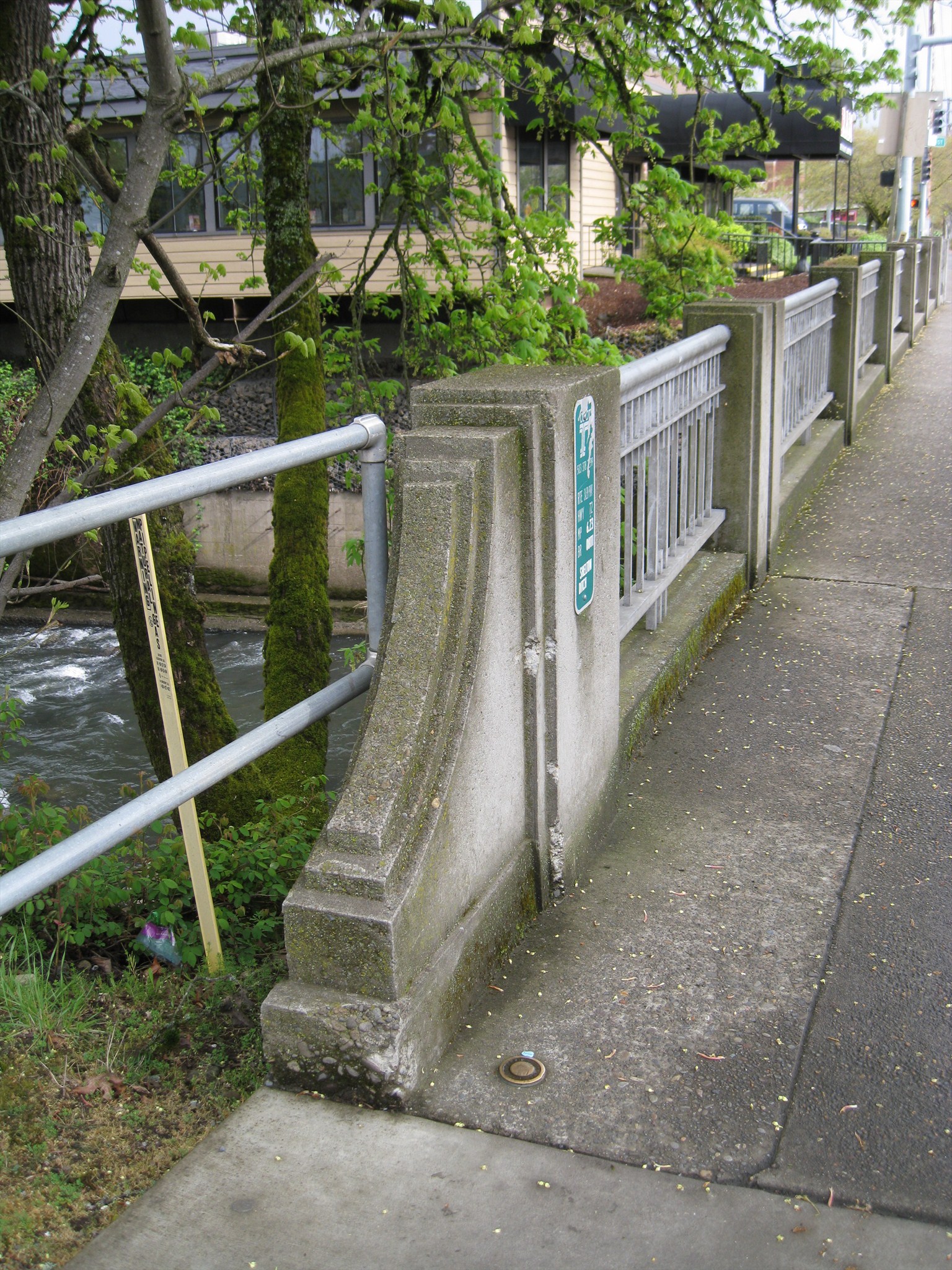
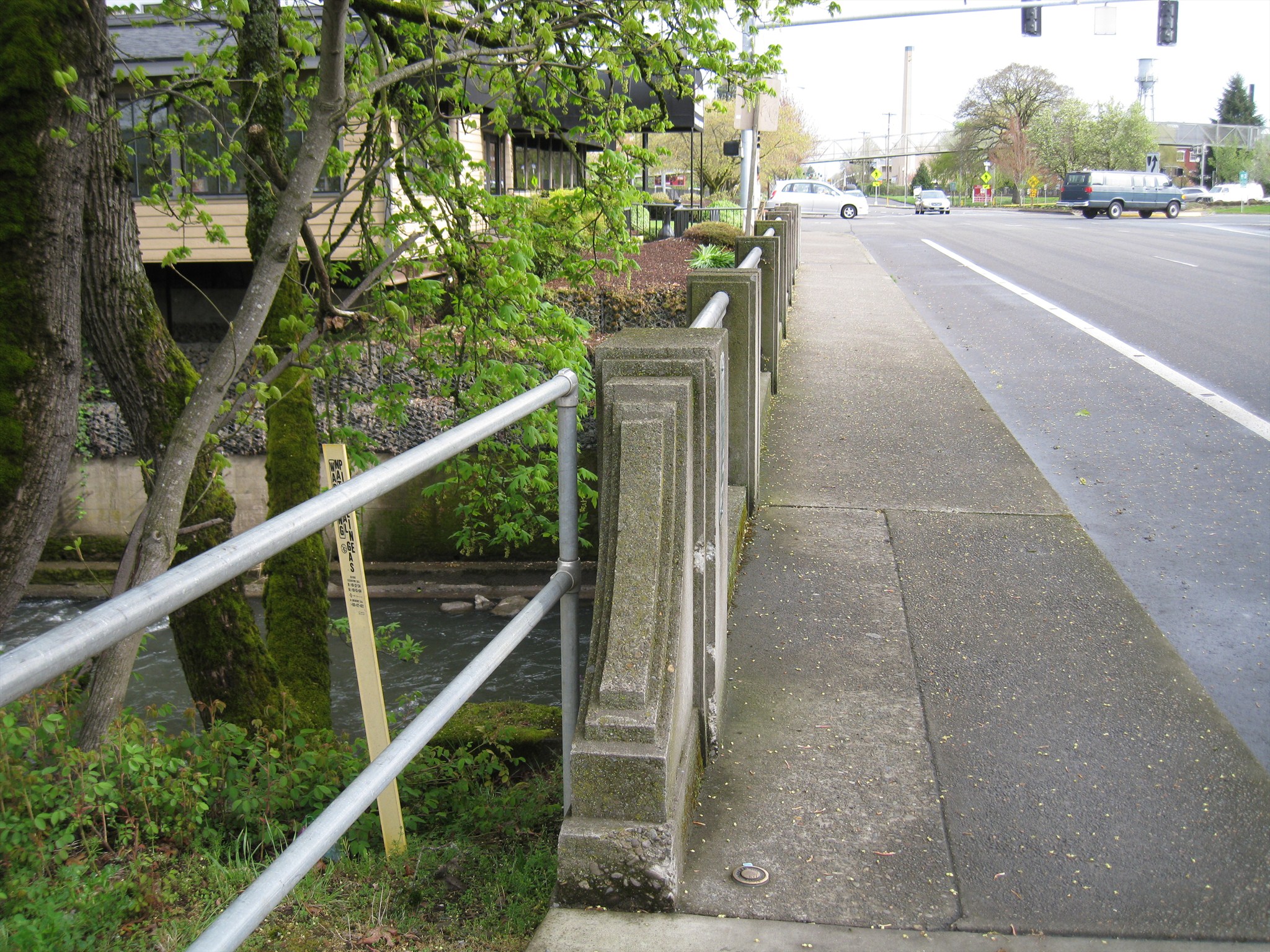
This benchmark is found on the bridge over Shelton Ditch on 12th Street, just south of The Ram Restaurant. It is embedded in the concrete near the rail on the west side of the bridge, at the south end.

Click a photo to enlarge

Condition: Mark found in good condition

Designation: 2056

Benchmark Agency: Not listed

Monumentation type: BENCH MARK (or B.M.) Disk

County: Marion

USGS 7.5' Topographic Quadrangle Name (optional): Salem West, Oregon

Find type: Found by luck/skill/knowledge

Benchmark Agency (if other): Not listed

Monumentation type (if other): Not listed

Special category (optional): Not listed

Special Category (if other): Not listed

Web address of this benchmark's datasheet (optional): Not listed

NGS PID: Not listed

Local database's URL (optional): Not listed

Visit Instructions:
  1. A closeup photo of the mark taken by you is required.
  2. A 'distant' photo including the mark in the view is highly recommended. Include the compass direction you faced when you took the picture.
Search for...
Geocaching.com Google Map
Google Maps
MapQuest
Bing Maps
Nearest Waymarks
Nearest U.S. Benchmarks
Nearest Geocaches
Create a scavenger hunt using this waymark as the center point
Recent Visits/Logs:
There are no logs for this waymark yet.