
Link River Falls - Klamath Falls, OR
N 42° 13.910 W 121° 48.043
10T E 598960 N 4676212
Klamath's own water 'falls' are more like rapids along the Link River and from where Klamath Falls derived its name in 1893.
Waymark Code: WMGFRG
Location: Oregon, United States
Date Posted: 02/28/2013
Views: 2
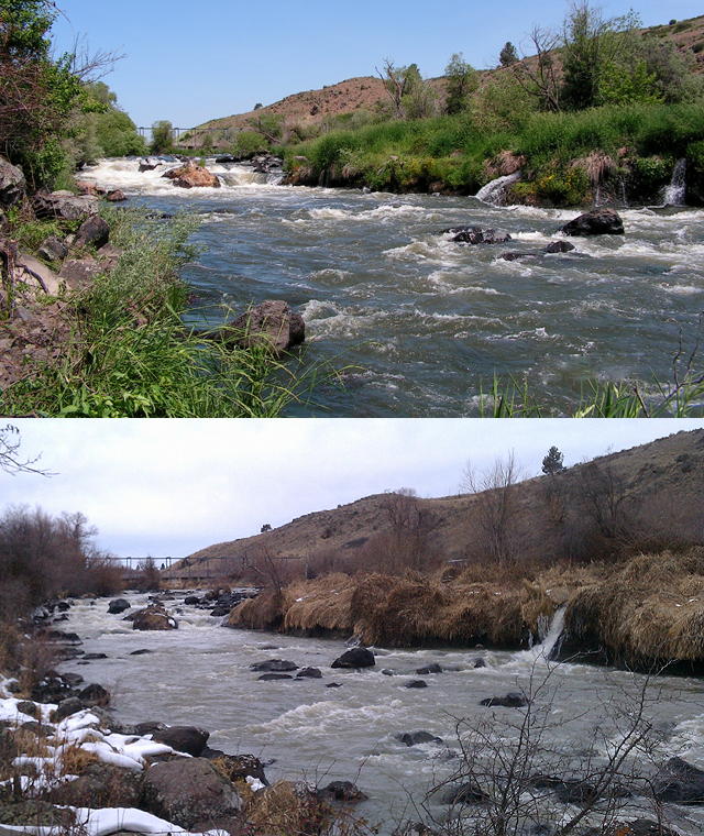
Many visitors to Klamath Falls often ask, "So where are the falls?". That question can be difficult to explain for many, considering the falls in question are more like small rapids that flow along the 1.3 mile-long Link River, which 'links' Lower Klamath Lake to Lake Ewauna and then into the Klamath River.
There's a very nice online PDF document from the Southern Oregon Visitors Association that highlights these falls and says the following:
‘‘Where are the falls?’’
That’s the first question asked by many visitors and newcomers to Klamath Falls. The query often meets with a blank expression from local residents who aren’t sure how to respond. Depending on the time of year, that can be a tough question to answer.
The city of Klamath Falls was originally named Linkville after a short river that links two lakes on either side of the town. Community leaders decided in 1893 to change the city’s name to Klamath Falls. Their idea was to ‘‘let the world know of our water power.’’ The falls they had in mind were apparently a series of rapids in Link River, where waters from Upper Klamath Lake spilled over a natural reef that served as the lake’s natural outlet.
A hydroelectric project built in 1921 significantly altered the Link River reef, virtually eliminating the rapids except during periods of high water. Today, a 1.3-mile hiking trail along Link River, maintained by Pacific Power, provides a pleasurable route for a nature hike.
_____________________________________________________
The coordinates I've posted are at a location where walkers along the Link River Trail can access a smaller trail that leads down to an outcrop of rocks and boulders and where one can appreciate these falls in all their glory. There is a small, wooden post just off the main trail that says 'FALLS' with an arrow pointing along the path towards the river (picture included).
Before the Link River Dam was built in 1921 a little further upstream from these falls, the Native Americans who once lived in this area would gather rocks into circles to divert large salmon into smaller tide pools and catch them for food to sustain them for the long winter months. The natives taught the white settlers to this area how to do the same and when water levels are very low during dry seasons, it is possible to see remnants of these rock circles just downstream from the waterfalls. Since dams have been built all along the Klamath River over the decades, the salmon no longer swim up river through here to spawn.
Even though these falls are diminutive compared to the much larger waterfalls that exist elsewhere, this body of water is very much an important symbol of Klamath Falls and at the minimum, a good conversation piece for citizens and non-citizens alike.