
Bonanza - Bonanza, OR
N 42° 11.887 W 121° 24.030
10T E 632056 N 4673010
This plaque is located in the Big Springs Park in Bonanza, OR.
Waymark Code: WMETPP
Location: Oregon, United States
Date Posted: 07/06/2012
Views: 3
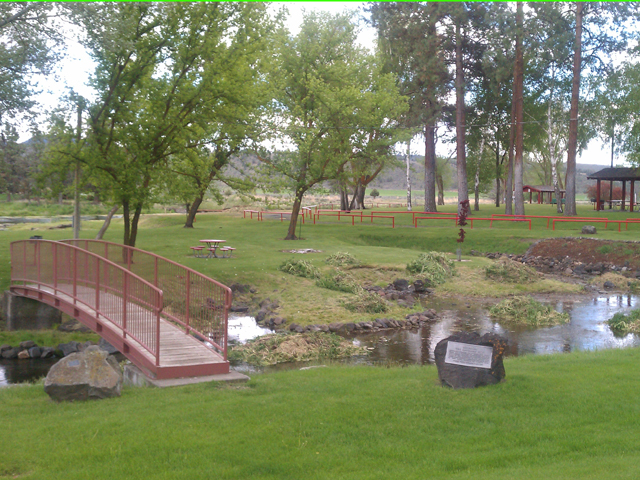
This plaque is imbedded in a lava rock boulder and sits next to a stream that leads into Lost River at the Big Springs Park and Recreational Facility in Bonanza, OR.
Marker Text:
BONANZA
"THE CLOVERLEAF CITY"
OFFICIALLY, BONANZA WAS FOUNDED JULY 11, 1873
WHEN IRA P. CHANDLER HOMESTEADED THE SITE.
UNOFFICIALLY, BONANZA WAS FOUNDED SOMETIME
PRIOR TO THE BEGINNING OF THE MODOC WAR,
WHEN JOHN S. SHOOK REP-EMPTED THE LAND EAST
OF LOST RIVER, OPPOSITE BIG SPRINGS PARK.
KLAMATH COUNTY HISTORICAL SOCIETY-1973
BONUS WAYMARK:
There is a Municipal Park waymark that can be visited and logged as well. Please click on the link below to visit this waymark:
Big Springs Park waymark
Visit Instructions:
Include your thoughts and observations pertaining to this location and your visit. Provide any additional history that you are aware of that pertains to this location. If the marker commemorates a historic building tell us what it is used for now or share with us the circumstances of an earlier visit to bring this locations history to life.
Please upload a favorite photograph you took of the waymark. Although visiting this waymark in person is the only thing required of you to receive credit for your visit, taking the time to add this information is greatly appreciated.
Be creative.