
Dover Boundary Marker Stone - Castle Hill Road, Dover, Kent.
Posted by:  MeerRescue
N 51° 07.947 E 001° 19.135
31U E 382379 N 5665897
A 'Pepper Stone', a Dover boundary stone sited alongside Castle Hill Road opposite the junction with Upper Road, Dover, Kent.
Waymark Code: WMEF9E
Location: South East England, United Kingdom
Date Posted: 05/21/2012
Views: 3
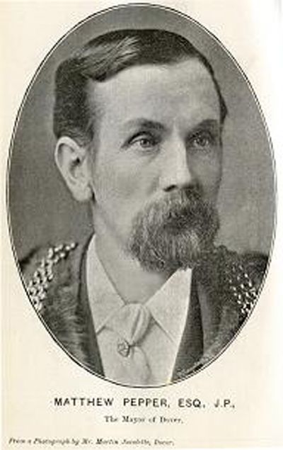
This Dover boundary marker, referred to
as a 'Pepper' stone, was one of a series of 'new' boundary stones set around the
town's boundary by Mayor of Dover Matthew Pepper in 1895-6.
Many are still visible around Dover,
this one sits outside the fence of the former Connaught Barracks, alongside the
coach park, opposite Upper Road in Dover.
Type of survey mark: Boundary Stone

What indicators are near the mark to help people identify where it is located?:
Sited on the small grass area at the end of the Pay & Display car park in Castle Hill Road Dover.
What property is this mark defining?:
Dover Town boundary.
|
Visit Instructions:
Please submit a photo(s) taken by you of your visit to the location (non-copyrighted photos only). GPS photos are also accepted with the location in the background, and old vacation photos are accepted. If you are not able to provide a photo, then please describe your visit or give a story about the visit. If you have additional information about the survey mark which is not listed in the waymark description, please notify the waymark owner to have it added, and please post the information in your visit log.
Recent Visits/Logs:
| There are no logs for this waymark yet. |
|
|
|