
72nd Indiana Regiment Mounted Infantry Marker - Chickamauga National Military Park
Posted by:  Lat34North
N 34° 54.360 W 085° 15.683
16S E 658841 N 3863998
This marker to the 72nd Indiana Regiment Mounted Infantry is located on the east side of Lafayette Rd, north of Vinyard-Alexander Rd in the Chickamauga National Battlefield.
Waymark Code: WMDJEN
Location: Georgia, United States
Date Posted: 01/20/2012
Views: 2
This marker to the
72nd Indiana Regiment Mounted Infantry, is in recognition of their service during the
Battle of Chickamauga, fought September 19–20, 1863. It marks their postion on Saturday, September 19, 1863 at 3:00 P.M. It is one of six markers to the 72nd Indiana on the battlefield.
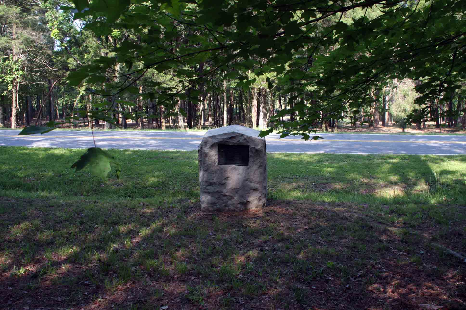 Text on the marker:
Indiana
Seventy-second Regiment Infantry
(Mounted) (Miller)
First Brigade (Wilder)
Fourth Division (Reynolds)
Fourteenth Corps. (Thomas)
Saturday, September 19th, 1863. 3 P.M.
From the NRHP nomination form:
| |
Structure Number: |
MT-826(see note) |
| |
LCS ID: |
008747 |
Historical Significance:
| |
National Register Status:
|
Entered - Documented
|
| |
National Register Date:
|
07/25/1986
|
| |
National Historic Landmark?: |
No
|
| |
Significance Level:
|
Contributing
|
| |
Short Significance Description:
|
Marker contributes to national significance of park under NR Criterion A because it represents national movement among veterans & related groupds to commemorate Civil War battlefields. This was the first U.S. national military park.
|
Short Physical Description
This standard Indiana regimental marker consists of a 4' x 4' x 4'8" high rock-faced oolitic stone block with a peaked top and a 12" x 18" bronze plaque affixed to its front. Marks regiment's position northeast of Viniard Field.
Material(s)
|
|
Structural Component(s)
|
Material(s)
|
1.
|
Superstructure
|
Limestone
|
2.
|
Superstructure
|
Bronze
|
3.
|
Substructure
|
Limestone
|
|
Construction Period:
|
Historic
|
Chronology:
|
|
Physical Event
|
Begin Year
|
Begin Year AD/BC
|
End Year
|
End Year AD/BC
|
Designer
|
Designer Occupation
|
1.
|
Built
|
1898
|
AD
|
|
|
|
|
|
My Sources
1. NRHP
2. Wikipedia - Battle of Chickamauga
3. The Civil War Home - The Chickamauga Campaign - Union Order of Battle
Note
Trailhead Graphics, Inc. has produced a map of the Chickamauga Battlefield showing the locations of all of the monuments and the markers on the battlefield. Each location on the map has a number associated with it that cross-references to an index on the back of the map that has the name of the marker (called the Chick-Chatt NMP monument numbering system). This number corresponds to the structure Number listed on the NPS List of Classified Structures that is normally prefixed with the letters MT for the Chickamauga Battlefield.
Website pertaining to the memorial: [Web Link]

List if there are any visiting hours:
Sunrise to sunset
Entrance fees (if it applies): 0.00
Type of memorial: Monument
|
Visit Instructions:
*(1.)* Please submit a photo(s) taken by you of your visit to the location (non-copyrighted photos only). GPS photos are also accepted with the location in the background, and old vacation photos are accepted. If you are not able to provide a photo, then please describe your visit or give a story about the visit.
*(2.)* If you have additional information about the memorial which is not listed in the waymark description, please notify the waymark owner to have it added, and please post the information in your visit log.