Orville Wright's First Virginia Flight
Posted by:  flyingmoose
N 38° 52.825 W 077° 05.034
18S E 319239 N 4305570
Located right next to the World's First Public Passenger Flight historical marker C-2. Both are located on route 50 and there is no immediate place to park as the two markers are wedged between route 50 and Fort Myer.
Waymark Code: WMDEC
Location: Virginia, United States
Date Posted: 05/25/2006
Views: 75
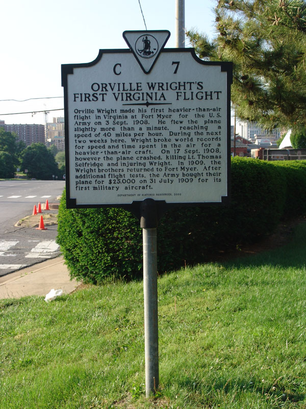
Orville Wright made his first heavier-than-air flight in Virginia at Fort Myer for the U.S. Army on 3 Sept. 1908. He flew the plane slightly more than a minute, reaching a speed of 40 miles per hour. During the next two weeks here, Wright broke world records for speed and time spent in the air for a heavier-than-air craft. On 17 Sept. 1908, however the plane crashed, killing Lt. Thomas Selfridge and injuring Wright. In 1909 the Wright brothers returned to Fort Myer. After additional flight tests, the Army bought their plane for $25,000 on 31 July 1909 for its first military aircraft.