
2010 Gas Pipeline Explosion - San Bruno, California
Posted by:  DougK
DougK
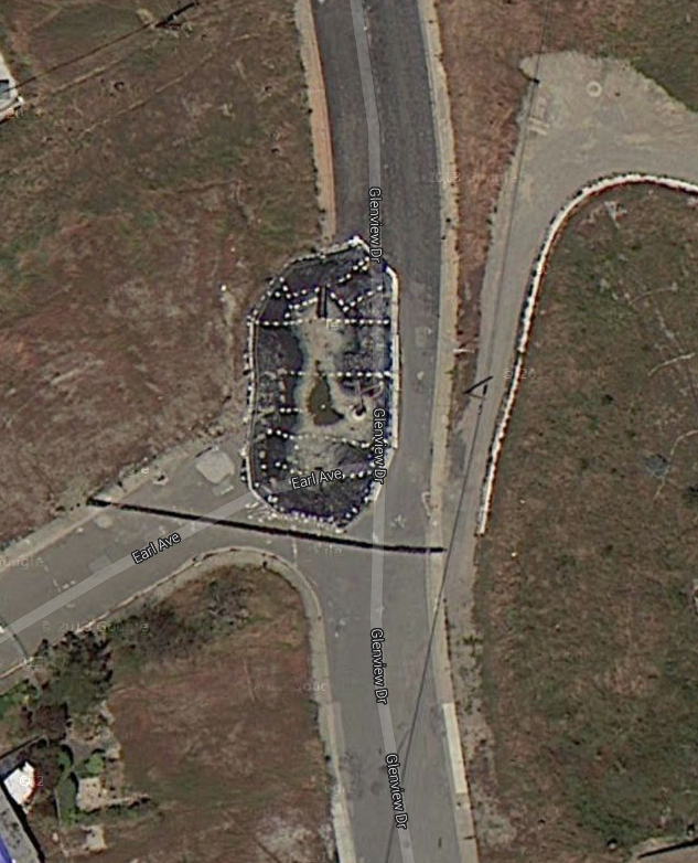
N 37° 37.351 W 122° 26.514
10S E 549249 N 4164080
On September 9, 2010, a PG&E gas pipeline exploded in the Crestmoor residential neighborhood, killing 8 people and leveling 35 nearby homes.
Waymark Code: WMCY7D
Location: California, United States
Date Posted: 10/25/2011
Views: 3
The 2010 San Bruno pipeline explosion occurred at 6:11 pm PDT on September 9, 2010, in San Bruno, California, a suburb of San Francisco, when a 30-inch (76 cm) diameter steel natural gas pipeline owned by Pacific Gas & Electric exploded in flames in the Crestmoor residential neighborhood 2 mi (3.2 km) west of San Francisco International Airport near Skyline Boulevard and San Bruno Avenue. The loud roar and shaking led some residents of the area, first responders, and news media to initially believe that it was an earthquake or that a large jetliner had crashed. It took crews nearly an hour to determine it was a gas pipeline explosion. As of September 29, 2010, the death toll was eight people. The U.S. Geological Survey registered the explosion and resulting shock wave as a magnitude 1.1 earthquake. Eye witnesses reported the initial blast "had a wall of fire more than 1,000 feet high".
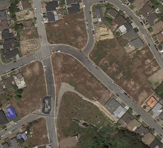 This caused a fire, which quickly engulfed nearby houses. Emergency responders of San Bruno and nearby cities soon arrived at the scene and evacuated surrounding neighborhoods. Strong winds fanned the flames, hampering extinguishing efforts. The blaze was fed by a ruptured gas pipe, and large clouds of smoke soared into the sky. It took 60 to 90 minutes to shut off the gas after the explosion, according to San Bruno Fire Chief Dennis Haag. The explosion and the resulting fire leveled 35 houses and damaged many more. Three more homes, deemed uninhabitable, were torn down in December, bringing the total to 38. About 200 firefighters continued to battle the eight alarm fire that resulted from the explosions. The explosion excavated an asymmetric crater 167 feet (51 m) long, 26 feet (7.9 m) wide and 40 feet (12 m) deep along the sidewalk of Glenview Drive in front of 1701 Earl Avenue (a corner house), but many of the destroyed homes were eastward in the 1600 block of Claremont Drive.
Source: Wikipedia
This fire / explosion is significant because it has resulted in a national review of inspections for utility pipelines.