
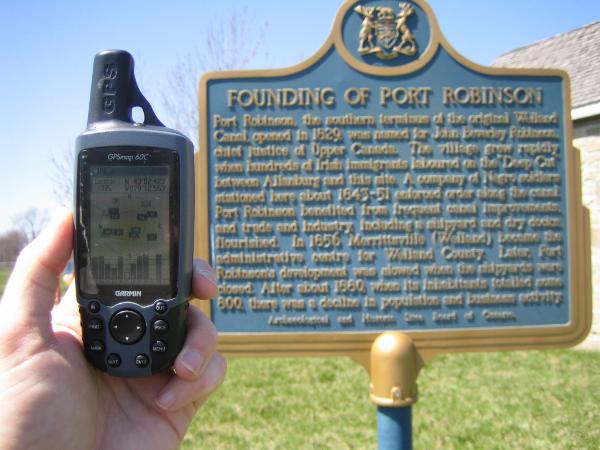
OHP - Niagara - Thorold - "Founding of Port Robinson"
N 43° 02.423 W 079° 12.552
17T E 645871 N 4766855
At the transfer point of the First Welland Canal, is the now tiny community of Port Robinson.
Waymark Code: WMCFQ
Location: Ontario, Canada
Date Posted: 05/13/2006
Views: 32
When navigation on the first Welland Canal began in 1829, the village of Port Robinson was called Port Beverly after Justice Beverly Robinson, a member of the original canal company. It was what was termed at the time a port of entry'. It was located at the junction of the canal and the Chippawa River, which provided access to the Niagara River and Lake Erie. In the second quarter of the 19th century it was the hub of transportation for the Niagara Frontier, the Niagara Peninsula and western New York State. Port Robinson could easily have become the principal town in the Niagara Region. All that remains of that period is St. Paul's Church.
Read more at Religion in Port Robinson

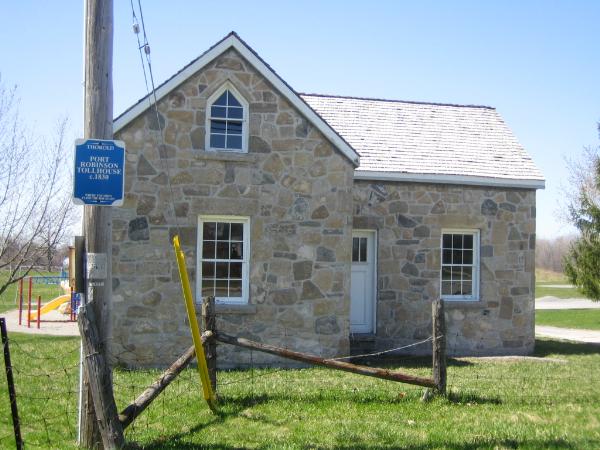
Location of Plaque: This plaque is on the East bank of the Welland Canal beside a relocated Tollhouse

Hope you enjoy the Visit
 The Blue Quasar