
Mt. Laurel - Potter's Field
N 39° 55.176 W 074° 55.423
18S E 506519 N 4418836
In 1743 John Penn donated this one acre of land for the purpose of burying the indigent.
Waymark Code: WMAC9
Location: New Jersey, United States
Date Posted: 04/13/2006
Views: 34
There are no gravestones, only a signal graveston and two wooden poles indicating the boundries of the plots.
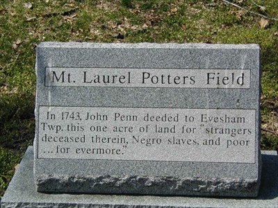
Marker Name: Mt. Laurel Potter's Field

Marker Type: Local? Unofficial
Marker text:
In 1743, John Penn deeded to Evesham Twp., one acre of land for stranger deceased within, negro slaves and the poor... for everyone.
Dedication Date: 09/14/1969
City: Mt. Laurel
County: Camden
Group responsible for placement: unknown
Web Link: [Web Link]
|
Visit Instructions:
A photo of the 'Marker' or 'Plaque' is required to identify the location, plus a picture of the 'Historic Site', please ALSO provide a detailed description of your visit so we can form a 'mental image'