
Mount Bierstadt Summit Register (14,060)
Posted by:  Team Laxson
N 39° 34.947 W 105° 40.147
13S E 442537 N 4381628
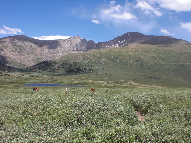
Mount Bierstadt is the 39th tallest peak in Colorado, towering 14,060 feet above sea level.
Waymark Code: WM96J7
Location: Colorado, United States
Date Posted: 07/06/2010
Views: 13
Mount Bierstadt Summit Register: 14,060 ft

Mount Bierstadt is the 39th tallest peak in Colorado, towering 14,060 feet
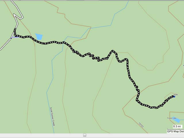
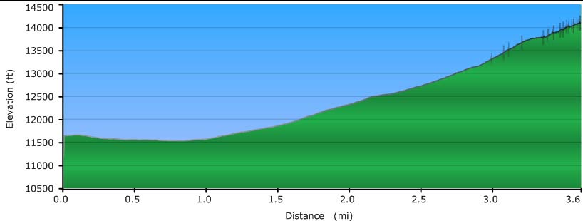
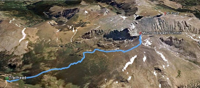
above sea level. Biestadt is often refered as 'the easy 14er, but don't let
that influence your decision to hike this trail. The trail (standard route)
gains 2,850 ft over 3.6 miles leading up to the summit, with the majority of
your hike being above tree line.
The summit register is a 2" Gray PVC pipe with white screw on ends. During
my visit (July 2010) one of the caps had been broken.
Driving Directions:
From Denver/North:
Get on I-70 heading West to Georgetown. From there, take CR381 South to the trailhead. The road is dirt and bumpy in places, but
should be passable in all types of vehicles. As always, proceed with your comfort level.
From South:
Get on Hwy 285 near Lakewood and head West to Grant. From there, take CR62 North to the trailhead (it turns into CR 381 once you cross the county border). The road is dirt and bumpy
in places, but should be passable in all types of vehicles. As always, proceed with your comfort level.