
Buford Mountain - Missouri
Posted by:  BruceS
N 37° 41.823 W 090° 41.361
15S E 703714 N 4174715
Buford Mountain is the 3rd highest mountain in Missouri.
Waymark Code: WM8ZRK
Location: Missouri, United States
Date Posted: 06/06/2010
Views: 6
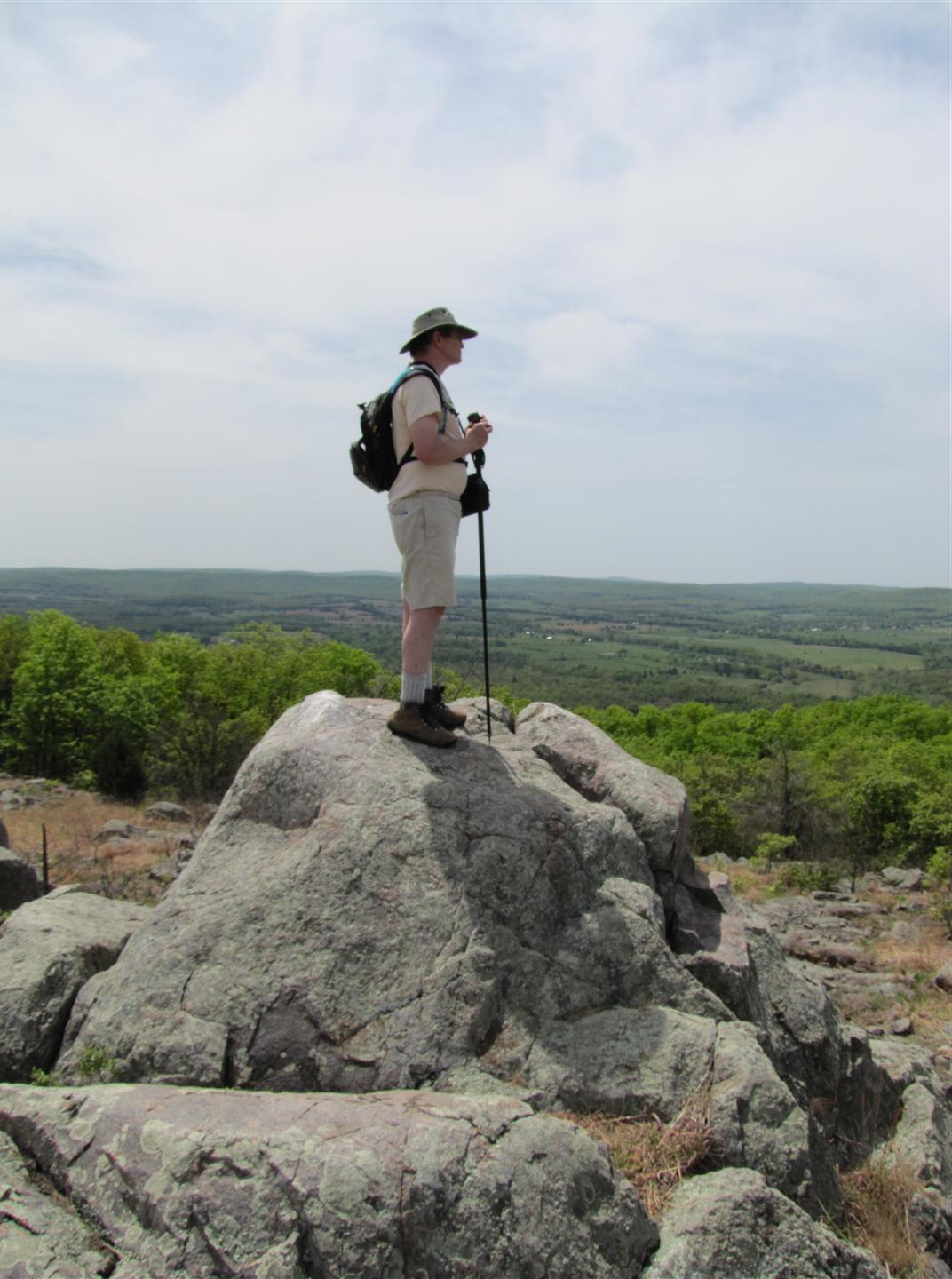
The Buford Mountain has a series of summits. The coordinates listed above is the highest, though less appealing than the others. The most significant summit is the fourth, known as Bald Knob located at N37° 42.909 W90° 42.655. Buford Mountain is in the Buford Mountain Conservation Area consisting 3,824 acres. The area was named after its settlement in 1812 by William Buford, who acquired the land through a Spanish Land Grant. In the mid- to late-1800s, the charcoal industry flourished in the Belleview-Arcadia Valley and old charcoal kilns are still supposedly located in the area though I have not seen them.
The Buford Mountain trail is a 10.5 mile trail with an interior loop. To access Buford Mountain park at the parking lot at N37° 40.864 W90° 41.575 and follow the road up to the trail head N37° 41.186 W90° 41.510. (note there is a parking lot right at the trail head however I have never seen the gate open allowing access to this upper lot, if the gate is open then park in this lot). Most of the elevation gain is within the first 3/4 mile. The high point is off to the east of the trail and as can be seen from the photos it will be hard to tell where the high point is. When you reach the trail junction where the interior loop of the trail begins take the left (west) trail as it will lead you to each of the successive "peaks". The trail crosses between the peak across the saddles between them. On each peak there are rocky glades with interesting flora and fauna and as mentioned the fourth named Bald Knob is the most scenic. Once reaching Bald Knob head west across the rocks of the glade to get a great view of the surrounding Acadia Valley area. (open up photo gallery as many photos have been uploaded)
Altitude in Feet: 1742

|
Visit Instructions:
To post a visit log for waymarks in this category, you must have personally visited the waymark location. When logging your visit, please provide a note describing your visit experience, along with any additional information about the waymark or the surrounding area that you think others may find interesting.
We especially encourage you to include any pictures that you took during your visit to the waymark.