Estes Cone (11,007) via Lily Lake Trailhead
Posted by:  Team Laxson
N 40° 17.715 W 105° 34.030
13T E 451795 N 4460682
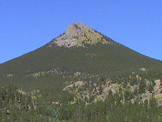
The hike to Estes Cone from the Lily Lake trailhead will take you over the Alpine Brook, a small waterfall, and give you an opportunity to view the Front Range of Colorado.
Waymark Code: WM8YR3
Location: Colorado, United States
Date Posted: 06/01/2010
Views: 5
Estes Cone
11,007
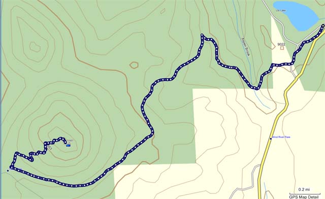
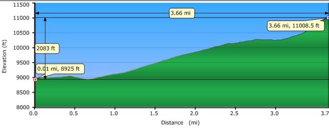
The hike to Estes Cone from the Lily Lake trailhead is 7.32 miles with a total of 2,083ft net elevation gain.
The hike will take you over the Alpine Brook, past a small waterfall, through forest land with a variety of different trees, all while giving you stunning views of nearby mountains.
The trail intersects at . From there, the summit is just 0.7 miles away, but it's a grueling of elevation gain to the top. The trail is marked with rock carins, but it's very easy to lose sight of them. Once at the top, look for the Eastern ridge to the summit. The views you'll be rewarded with will make your efforts worth it!