
Katova ulicka / The Headsman's Lane - Kadan (North-West Bohemia)
N 50° 22.607 E 013° 16.293
33U E 377101 N 5581952
Only 66 cm wide medieval lane through the stone fortification, called Katova ulicka ("The Headsman's Lane"), belongs to the major touristic attractions in Royal Town of Kadan...
Waymark Code: WM8MZH
Location: Ústecký kraj, Czechia
Date Posted: 04/21/2010
Views: 130
Only 66 cm wide medieval lane through the stone fortification, called Katova ulicka ("The Headsman Lane"), belongs to the major touristic attractions in Royal Town of Kadan.
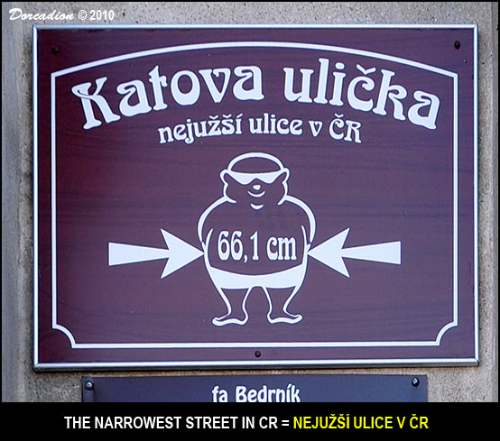
The Headsman's Lane, dating from the turn of the 13th and 14th centuries, is a meter-narrow space delimited by two houses, paved with granite stones, leading from Mírové námestí to a fence behind the fortification wall near the so-called Katovna. Numerous flying buttresses ("prampouchy" / "Schwibbogen") are arched across the Lane. Its length is approximately 50 m, in the narrowest place it is only 66.1 cm wide.
The Headsman's Lane, which connects the center of the Old Town with the Hospital Suburbs, was established together with the Executioner's Gate at the beginning of the 14th century as part of the first line of the Kadan walls. This fortification element is located between the burgher houses N° 76 and 77. During the town's siege, the Lane served as a fast connection between the main square and the fortified zwinger. In the Middle Ages, it was the only entrance to the city at night, because the other gates were closed at ten o'clock in the evening. At the same time, it served as a sewer, which drained excess water from the former three fountains on the main square to the now piped Bystrice brook and also to the moat. On the contrary, in times of drought, the shortest route for the transport of utility water from the mentioned stream to the city led through the Lane. According to tradition, the Kadan executioner walked down Katova Street.
The Headsman's Lane together with Headsman's Gate (Katova branka), Headsman's House (Katový dum) and Headsman's Piazza (Katuv plácek) form a unique architectural and urban complex with more than 700 years of Kadan historical development. It is registrated as a part of the street Sokolovská by the agency "Dobrý den" in Pelhrimov as the narrowest street in the Czech Republic.
Source: excerpted and translated from
Wikipedia
and
National Heritage Institute portal.
Visit Instructions:As a suggestion for your visit log, please make every effort to supply a brief-to-detailed note about your experience at the Waymark. If possible also include an image that was taken when you visited the Waymark. Images can be of yourself, a personal Waymarking signature item or just one of general interest that would be of value to others. Sharing your experience helps promote Waymarking and provides a dynamic history of your adventures.