
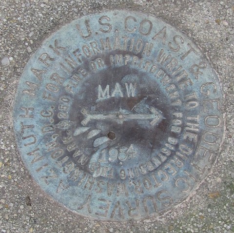
MAW - Malden, Missouri
Posted by:  gparkes
N 36° 33.339 W 089° 54.594
16S E 239556 N 4049522
This Azimuth point is located near an air navigation VORTAC.
Waymark Code: WM8E23
Location: Missouri, United States
Date Posted: 03/19/2010
Views: 2
That funny looking building, that looks like an upside down ice cream sandwich is actually a VOR (VHF Omnidirectional Range), a facility ran by the Federal Aviation Administration, providing air navigation radio signals to the flying public.
The VOR is surrounded by farm land, that over the years has produced cotton and rice.
Directions: the Azimuth point is located down the road leading to the VOR through the farm land. It is at the point where the road turns 90 degrees to the right.
Visitors that go should remember it is a Federal crime to interfere with Air Traffic operations and disturb the VOR site. Stay on the outside of the gated site.