
The Priest's Landing - Lindsay, Ontario, Canada
N 44° 20.060 W 078° 43.605
17T E 681230 N 4911520
This plaque is located in the Riverside Cemetery at Lindsay Street S. in Lindsay.
Waymark Code: WM874Z
Location: Ontario, Canada
Date Posted: 02/11/2010
Views: 7
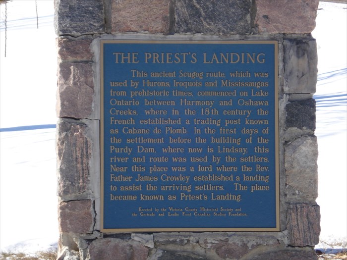
THE PRIEST'S LANDING
This ancient scugog route, which was used by Hurons, Iroquois and Mississaugas from prehistoric times, commenced on Lake Ontario between Harmony and Oshawa Creeks, where in the 18th century the French established a trading post known as Cabane de Plomb. In the first days of the settlement before the building of the Purdy Dam, where now is Lindsay, this river and route was used by the settlers. Near this place was a ford where the Rev. Father James Crowley established a landing to assist the arriving settlers. The place became known as Priest's Landing.
Erected by the Victoria County Historical Society and Gertrude and Leslie Frost Canadian Studies Foundatian.