
Rogue River Gorge Viewpoint - Oregon
Posted by:  Volcanoguy
N 42° 54.607 W 122° 26.578
10T E 545468 N 4750984
Viewpoint on Ore. Hwy. 62 near the community of Union Creek.
Waymark Code: WM7QNQ
Location: Oregon, United States
Date Posted: 11/23/2009
Views: 8
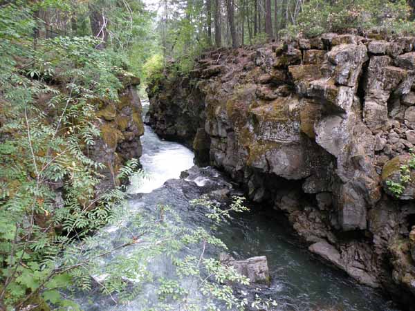
This viewpoint is located about a quarter mile north of the community of Union Creek, just off Ore. Hwy. 62. This viewpoint was constructed by the Rogue River National Forest as an interpretive site for the Rogue River Gorge. There is a large parking lot with room for large vehicles, a quarter mile loop trail that takes you to 4 overlooks of the Rogue River Gorge, an interpretive kiosk, trail signs, and restrooms.
Text of “The Upper Rogue River ... Visits Through Time” sign: The Gorge has long been a popular stopping point along the upper Rogue River. It was no doubt visited by the Takelma and Klamath Indians during their travels through the wilderness.
In the 1860s Rogue Valley settlers built a wagon road that passed a few hundred feet from this spot. On their way over the mountains, some of them paused here to view the Gorge.
By the turn of the century, Crater Lake was a famous scenic attraction. During the 1920s, a paved highway to the Lake was built near the Gorge; many tourists stopped and walked the few steps to its edge.
Just like those earlier travelers -- who were drawn by the sound of the River to the edge of the Gorge -- you too will experience the power of the upper Rogue.