
Comancheria - Snyder, Oklahoma
Posted by:  gparkes
N 34° 37.868 W 098° 50.206
14S E 514961 N 3832150
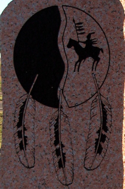
This beautiful marker is on the back of the Quanah Parker marker. Oklahoma occasionally will use the back of markers so that two stories can be shared that are relavent at a location.
Waymark Code: WM7KY1
Location: Oklahoma, United States
Date Posted: 11/06/2009
Views: 14
Comancheria
The domain of the Comanches from early 1700's to Mid 1800's.
Reached from the foot hills of the Rockies to New Mexico. Eastward to the cross timbers of Texas and Oklahoma and from the Arkansas River to Kansas , south to the Texas Pecos River, Rio Grande area. The Nation was 600 miles from north and south, 400 miles from East to West.
Among the 1st Plains Indians to acquire horses from Spanish settlers. Comanches soon became legendary horsemen.
Seizing control of Comancheria and securing there Land of Waving Grass and Buffaloes from intruders.
These ancient Washita Mountains you are now viewing were center in the heart of Comancheria and scared to the Comanches. The aged Ceders used in ceremonial for centuries still stand guard.
Dedicated to the preservation of the NUMUNUU
The Comanche Nation this Quanah Parker seneic turnout was erected in 1997 by the Dept of Transportion and the Jackson County Historical Society.