The coordinates for this waymark are for the Scappoose Trailhead two miles from the intersection of Highway 30 and the Vernonia Highway and four miles from Chapman Landing (the end of the trail).
In 1906, Fred and Simcoe Chapman began constructing a railroad from Chapman landing up into the woods past Camp 8. Where the grade became too steep, a tunnel was built in 1910. The Nehalem Divide Railroad tunnel between Champan and Pittsburg is 1712 feet long. It is listed in the National Register of Historic Places, but it is not part of the trail and it is not open to protect the public and the tunnel.
In 1943, Crown Zellerbach acquired the rail line, and converted it into a logging road. The tunnel could not be converted for log trucks, so its use was discontinued and a road was built through a different pass.
In 2004, Columbia County purchased the Crown Zellerbach Logging Road from the Hancock Timber Company with grants from the Oregon Department of Transportation and Oregon State Parks.
Chapman Landing: N 45° 44.716' W 122° 50.458' the trail begins at the Multnomah Channel of the Columbia River. Chapman Landing is the future site of a proper county park. UPDATE: the city has secured this property for a park. Little work has been done, but big plans are being made (06/11/2020). There is no parking here; the nearest access point is where E Columbia Avenue intersects the trail 0.4 miles from Chapman Landing.


Access Point: East Columbia Avenue, N 45° 45.030' W 122° 50.676', 0.4 miles from Chapman Landing, sufficient parking for a horse trailer. As of 2011, there are much improved shoulders for parking. There are no signs, but posts and gates prohibit motorized vehicles.
Access Point: Miller Road, N 45° 45.504' W 122° 51.582', 1.3 miles from Chapman Landing. This access point is very near a park with bathrooms and parking. There is a dispenser of small garbage bags for cleaning up after your dog mounted on a fence at this point.
Access Point: Bird Road, 45° 45.546' W 122° 51.756', 1.5 miles from Chapman Landing. There is probably only enough parking at this location for one or two cars. There is a concrete bench under a tree at this location.
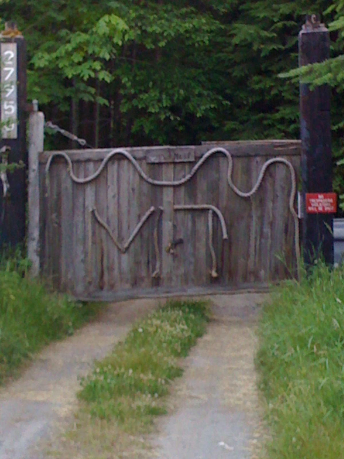
Access Point: West Lane Road, N 45° 45.672' W 122° 52.218', 1.9 miles from Chapman Landing, sufficient parking for a horse trailer. As of 2009, there is no proper parking or signage. Posts and gates prohibit motorized vehicles. (WM79JB)
At this point the trail is maintained as a three-lane road with curbs, sidewalks and bike lanes (0.1 miles).
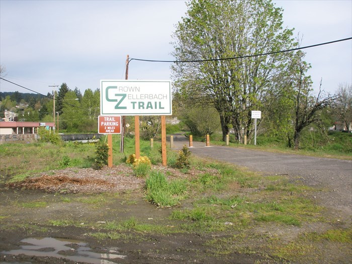
Scappoose: just west of the intersection of Highway 30, the trail gets off the road again. The trail surface from Chapman Landing to Highway 30 (2 miles) is paved with asphalt. The trail surface from Highway 30 to Vernonia (15 miles) is gravel. This point on the trail has a real sign indicating that proper parking is available two miles ahead.
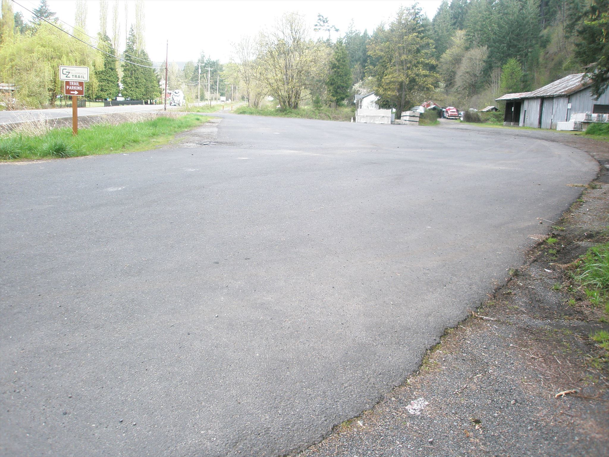
Scappoose Trail Head: N 45° 46.983' W 122° 54.206', 4.1 miles from Chapman Landing. This trailhead has a proper sign and lots of parking, plenty of room for horse trailers. This is the best place to begin you exploration of the trail. The trail north of this point is significantly more scenic than the trail south of this point.
Access Point: Deane Drive, N 45° 47.820' W 122° 55.022', 5.3 miles from Chapman Landing. There is probably only enough parking at this location for one car.
Access Point: Pioneer Road, N 45° 47.865' W 122° 55.126', 5.4 miles from Chapman Landing. There is enough parking at this location for several cars, but it is off road parking, not paved.
Access Point: Pond Drive, N 45° 47.017' W 122° 55.753', 6 miles from Chapman Landing. There is probably only enough parking at this location for one car.
Landslide: N 45° 48.412' W 122° 56.272', 6.7 miles from Chapman Landing. At this point the trail becomes nearly impassable. It is necessary to clamor over piles of dirt and debris. It appears that there was a landslide at some point in time. As of 2011, a bulldozer has not been brought in to remove the material.
Access Point: Walker Road, N 45° 48.546' W 122° 56.289', 6.9 miles from Chapman Landing. There is probably only enough parking at this location for one car.
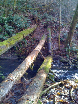
Alder Creek: N 45° 49.377' W 122° 56.641', 7.6 miles from Chapman Landing. At this point the trail crosses Alder Creek, but there is no bridge. It could be waded, but fortunately, there are several fallen trees which are easy to walk across. UPDATE: a very nice bridge has been installed at this location!
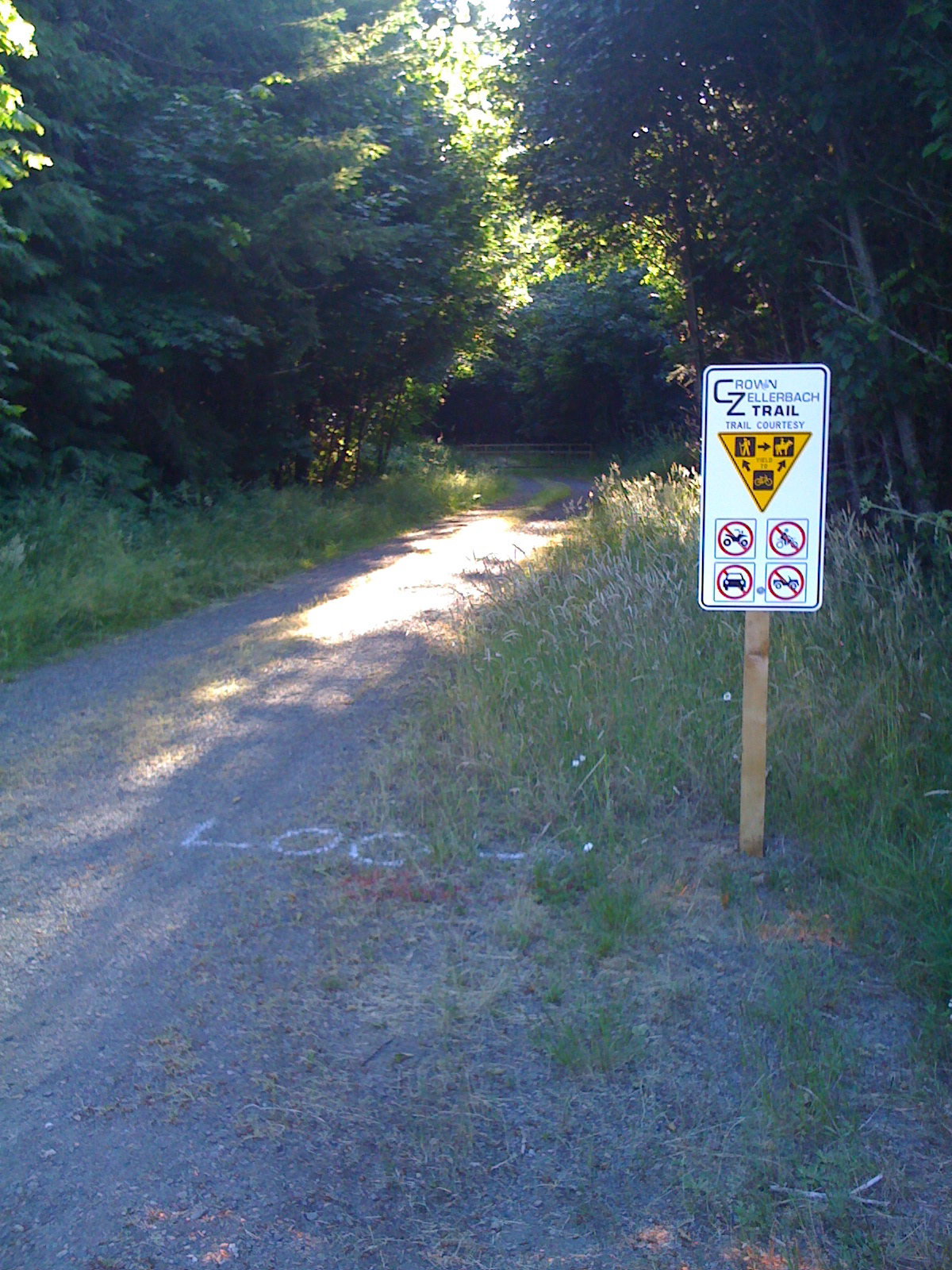
Cater Road: N 45° 49.489' W 122° 57.026', 8.1 miles from Chapman Landing. At this point the trail crosses from the north side of the Scappoose Vernonia Highway to the south side of the highway. This is the future site of another proper trailhead, but as of 2011, the only signage is in place explains that proper trail etiquette is that bicyclists should yield to hikers and both bicyclist and hikers should yield to equestrians.
Access Point: Hale Road N 45° 49.528' W 122° 57.514', 8.8 miles from Chapman Landing.
Access Point: Chapman Grange Road N 45° 49.492' W 122° 58.394', 9.6 miles from Chapman Landing.
Access Point: Chapman Road N 45° 49.544' W 122° 58.534', 9.7 miles from Chapman Landing.
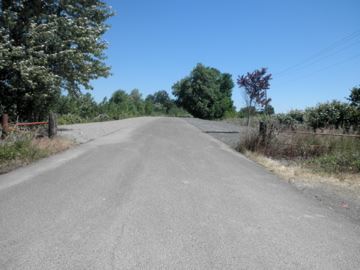
the summit:
Chapman: 10 miles from Chapman Landing.
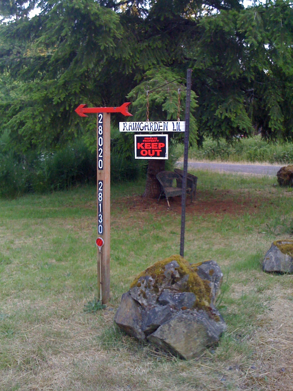
Access Point: Rain Garden Lane N 45° 49.577' W 122° 59.485' 10.5 miles from Chapman Landing. Rain Garden Lane is a very short road with three residences. Each of them has clearly marked their property: no trespassing.
Access Point: Pisgah Lookout Rd, N 45° 49.894' W 123° 02.789', 13.9 miles from Chapman Landing.
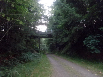
Nehalem Divide: N 45° 49.936' W 123° 02.791', 13.9 miles from Chapman Landing. At this point the trail passes under the highway.
Scaponia Recreation Site: 17.1 miles from Chapman Landing.
Camp 8: N 45° 52.061' W 123° 07.261', 19.7 miles from Chapman Landing.
UPDATE 06/28/2011: As noted, there are many signs posted along the trail that read PRIVATE PROPERTY and NO TRESPASSING. Please take care not to wander from the trail onto private property or attempt to access the trail by trespassing through private property. The neighbors have been edgy about public use of the trail since the trail was proposed. Also, please clean up after your dog, and don't let dog trespass either. It's a wonderful trail and it should be enjoyed by as many people as possible, but we all need to be respectful of each other.