St. Croix Falls Dam - St. Croix Falls, WI
N 45° 24.761 W 092° 38.744
15T E 527720 N 5028856
The St. Croix Falls Dam is a hydroelectric dam on the St. Croix River in St. Croix Falls, Wisconsin, USA.
Waymark Code: WM75BM
Location: Wisconsin, United States
Date Posted: 09/04/2009
Views: 6
From the
Xcel Energy website:
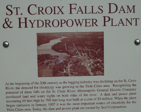
The St. Croix River is a federally designated natural and scenic river way, and St. Croix Hydro is the only existing dam on the river. Completed in 1907, the plant was built to provide electricity across the river to Minneapolis-St. Paul. A feature that distinguishes the St. Croix Falls plant from other Xcel Energy hydros is its S-shaped spillway. The spillway had to be constructed as a curve to increase its crest area, because the river at the site forms a gorge through which passes a large volume of water.
The posted coordinates are located above the dam on the Wisconsin side of the river at a viewing location with information about the dam. A close-up of a sign at the viewing location is below: