
Cape Cod Canal Trail - Buzzards Bay, MA
Posted by:  silverquill
N 41° 44.594 W 070° 36.836
19T E 365799 N 4622526
The Cape Cod Trail is a multiuse paved trail along extending for about seven miles along the Cape Cod Canal from the landmark vertical lift railroad bridge to the Bourne Bridge. There is an extension that continues another seven miles.
Waymark Code: WM7409
Location: Massachusetts, United States
Date Posted: 08/29/2009
Views: 7
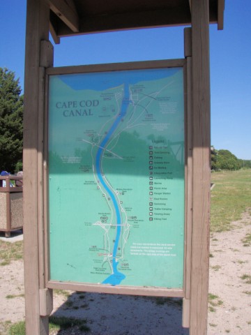
The main access point for this trail is here at the Buzzards Bay Recreationl Area at the foot of the historic Cape Cod Canal Railroad Bridge. This is a bike and walking path that is paved and lined. There are benches along the path with magnificent views of the canal, with the passing ships and sailboats, and the scenic bridges to the north and south. There is ample parking at this 20-acre park off of Main St. in Buzzards Bay.
Trailhead/trail website: [Web Link]

Trail allowances or restrictions:
Pedestrians and bicycles only. No motorized vehicles.
Trail type: Paved
Parking: Not Listed
|
Visit Instructions:
To claim a log for this waymark, some proof of a visit is required. This proof could be a simple photo of their GPS at the trailhead, a photo of the person at the trailhead, or a photo of a signature item that a person uses for photographs, at the trailhead.
In order to help other waymarkers who are looking for a nice hike/walk outdoors, you are encouraged to provide good feedback about the quality of the hike/trail.