Mt. Lady Washington (13,281)
Posted by:  Team Laxson
N 40° 15.808 W 105° 36.446
13T E 448349 N 4457177
A beautiful hike in Colorado's high country, the hike to the summit of Mt. Lady Washington will offer you the best view of Longs Peak in Colorado, waterfall crossings, a forest of trees, wildlife, wildflowers, and a wide variety of other
Waymark Code: WM6VXK
Location: Colorado, United States
Date Posted: 07/25/2009
Views: 5
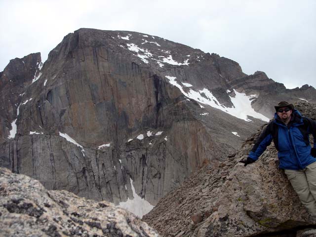
Meeker, Longs, and Mt. Lady Washington
This hike is not to be taken lightly, with 6.5 miles of trail to the summit, you will gain almost 4,000 ft. of elevation along the way. But, if you want to see the best of what Colorado has to offer, this hike is not to be missed.

Meeker, Longs, and Mt. Lady Washington
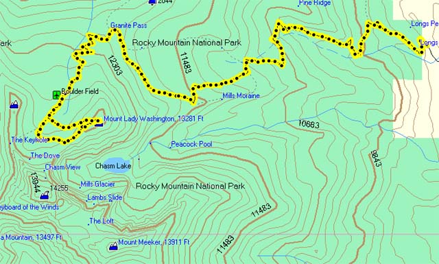
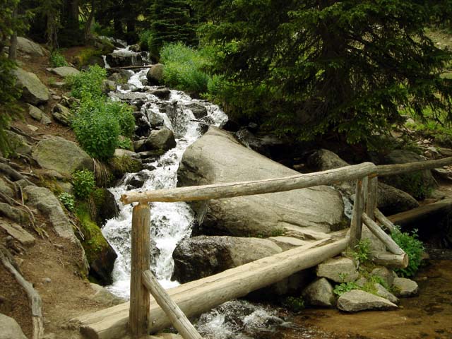
The hike begins at the Longs Peak Ranger Station, and follows the Longs Peak trail for most of the way. After 2 miles of hiking, you'll cross the Alpine Brook and enjoy the refreshing sound of water rushing past you.
Once past the Brook, keep on going, enjoying the wildlife, flowers, and other things of beauty along the trail. At 5.6 miles into the hike, you'll cross the Boulder Field. It's just that - a great big field with very large boulders. After that, hike along the ridge to your left and summit this amazing mountain, and you'll be rewarded with a truly amazing view.