
Shore Bound Smokey - Folsom, NJ
N 39° 36.129 W 074° 50.595
18S E 513457 N 4383613
This smokey sits in a dusty, hard packed dirt area off the intersection of Rt. 54 and Mays Landing Rd. (A spur of Rt. 73). This smokey is HUGE and asks us to prevent fire fires. It was placed by the N.J. Forest Fire Services.
Waymark Code: WM6R20
Location: New Jersey, United States
Date Posted: 07/11/2009
Views: 4
This Smokey is the largest I have seen. It is on a stretch of road which connects Rt. 73 to the Black Horse Pike, and if you are traveling down the shore using this "short cut", smokey is on the right side, about 20 feet off the side of the road.
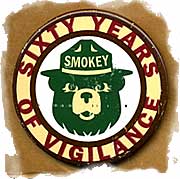
Although most people tend to associate Smokey Bear and wildfires with conflagrations raging across western states, both have played a major role in the history and current daily life of New Jersey and one -- the bear -- celebrated his 63rd anniversary this year in September.
The "Only You Can Prevent Forest Fires" promotion conducted by the U.S. Forest Service, the National Association of State Foresters and the Ad Council, is the world's longest-running public service advertising campaign. Tto the surprise of many in my home county, Smokey Bear has been very active (in Camden County) and the rest of New Jersey during all those years.
This particular Smokey is on the border of Camden and Atlantic Counties.
Coordinates are insanely accurate!