
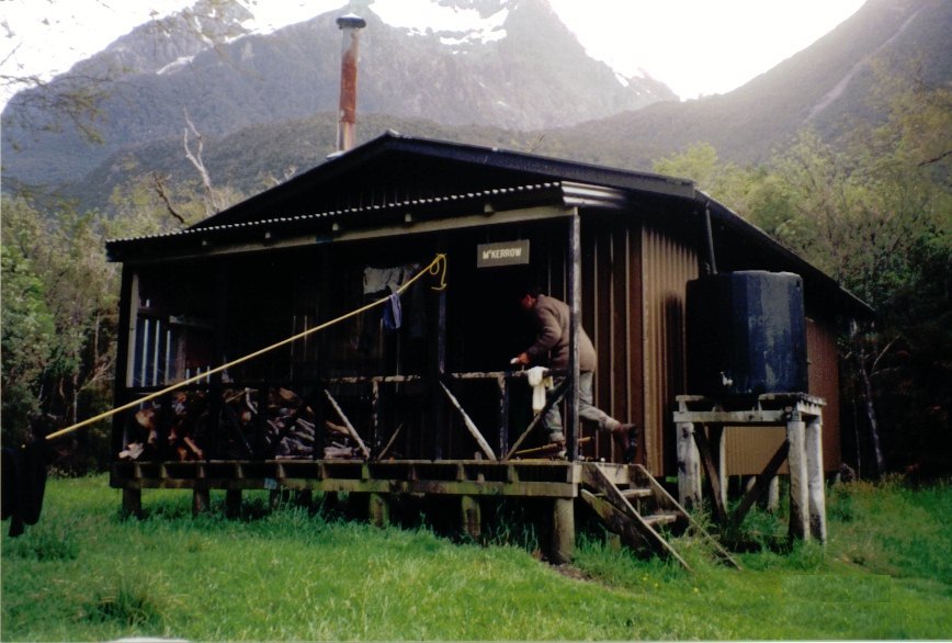
McKerrow Island Hut
Posted by:  StagsRoar
S 44° 31.068 E 168° 03.811
59G E 266625 N 5066418
Located on McKerrow Island at the head of Lake McKerrow - South Island of New Zealand
Waymark Code: WM57D
Location: South Island, New Zealand
Date Posted: 12/23/2005
Views: 64
Lake McKerrow is situated on the Back-side of the Pembroke Wilderness area of
Fiordland and is part of the Lower Hollyford River watershed. The Island at the head of the lake is formed by the Hollyford River as it enters the lake turning west then north as it flows into the lake with a flood channel continuing straight north where the river bends west - the Island thereby fronts onto the lake on it's north side with its south and west side being the river and the east side being the flood channel. This flood channel needs to be waded to access the Island and therefore some homework will need to be done before intending to venture there as if the Hollyford River is high then the flood channel will most likely be unwadable. As it was when I crossed it the Hollyford was not high yet the flood channel depth was still approx 100cms+ deep. On this 1km x 1km island is the McKerrow Island hut. Access to it is approx 9hrs from the road end of Gunns Camp off the Milford Road and is part of the
Hollyford - Martins Bay - Pyke River walk.
Alabaster Hut is approx 3 hrs further back on the Pyke watershed. If the flood channel is to high to cross then you do actually have the option of carrying on to the Demon Trail Hut which is another few hours walk further up the east side of the lake.
For the most part the McKerrow Is hut is the lesser used of the trail as most people do tend to carry on over the Demon Trail as part of their pilgrimage to Martins Bay on the coast.
Mckerrow Island is as stated approx 1km x 1km (maybe a little bigger) and is densely wooded with native Kowhai Trees making the birdsong of a morning and through the day melodic with
Native Birds such as Tui & Bellbird. The Island itself is approx 15 kms from the sea yet I have seen seals venture here in search of trout and salmon which frequent the lake and river. Dolphins are not unheard of on Lake Mckerrow either as they venture up the Lower Hollyford river for similar purposes.
The Hut itself is a 12 bunk hut with an adequate open fireplace so bring your own cooking gear and candles.
Good information on this walk and others like it can be found in the book
'Moirs Guide South' which I would advocate as recommended reading.
Treat the hut and surrounding bush with respect. Go easy on the firewood which can sometimes be found in the form of driftwood around the Islands brim.