Frenchman Springs Coulee, Washington
Posted by: Groundspeak Premium Member Rose Red
N 47° 01.861 W 119° 57.273
11T E 275515 N 5212848
Frenchman Springs Coulee is just north of Interstate 90, about four miles southwest of George, Washington.
Waymark Code: WM4E2V
Location: Washington, United States
Date Posted: 08/11/2008
Published By:Groundspeak Premium Member Blue J Wenatchee
Views: 83


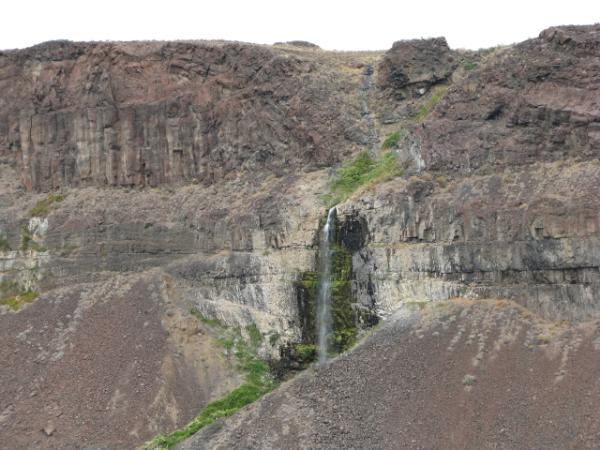
According to David Alt’s “Glacial Lake Missoula,” the main flood route out of the Quincy Basin was straight west through the broad valley of Lower Crab Creek to the Columbia River. Some of the water spilled over the ridges. For example, water spilled over Babcock Ridge at the west edge of the Quincy Basin eroding the scabland channels at Frenchman Springs Coulee. Frenchman Springs Coulee is just north of Interstate 90, about four miles southwest of George, Washington. It includes a classic dry waterfall that overlooks the Columbia River.

Visit Instructions:
You must actually visit a feature to post a log for it. You must post a picture that you have taken at the feature to have the waymark approved. It has to be in one of the states listed above.
Search for...
Geocaching.com Google Map
Google Maps
MapQuest
Bing Maps
Nearest Waymarks
Nearest Glacial Lake Missoula Flood Features
Nearest Geocaches
Create a scavenger hunt using this waymark as the center point
Recent Visits/Logs:
Date Logged Log User Rating  
The A-Team visited Frenchman Springs Coulee, Washington 08/15/2022 The A-Team visited it
Moun10Bike visited Frenchman Springs Coulee, Washington 03/23/2012 Moun10Bike visited it
Cool Cow Cachers visited Frenchman Springs Coulee, Washington 09/25/2011 Cool Cow Cachers visited it
Rose Red visited Frenchman Springs Coulee, Washington 08/10/2011 Rose Red visited it
PYNEKONE visited Frenchman Springs Coulee, Washington 07/17/2011 PYNEKONE visited it
Volcanoguy visited Frenchman Springs Coulee, Washington 09/23/2009 Volcanoguy visited it

View all visits/logs