|
 Manteca, California - Where Trains Ride Into The Sunset
N 37° 47.655 W 121° 12.874
10S E 657199 N 4184488
A recreational trail parallel to Union Pacific Railroad's main track
Waymark Code: WM47WM
Location: California, United States
Date Posted: 07/19/2008
Views: 69

Click on any picture for larger images.
Click the blue links for more information and other nearby waymarks.
Manteca would not exist without the railroad. In 1869, the last piece of America's first Transcontinental Railroad was completed right here. This site, a bridge across the San Joaquin River has been used by the Union Pacific Railroad ever since.
The town even owes its name to the railroad. Well, rather, the town blames the railroad for its name: In 1911, the most successful business in the little, still nameless settlement was to get its own railroad stop. The place was the Community Dairy and the logical name suggested for the stop was Monteca, Spanish for cream. But instead, due a typo, the stop was listed as Manteca, Spanish for lard. The typo was never corrected and today, 100 years later, 66,000 people live in Lard.
|
 |
|
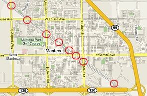
Today, the train doesn't stop in town anymore. Instead, freight trains from or to the port of San Francisco run diagonal across town at least once every hour, crossing all of its eight main streets. Plans for a commuter train from Manteca to the Bay Area are in the works, but for now, our main contact with the railroad is at the railroad crossings.
|
Manteca's favorite past time: waiting at a railroad crossing
 |
|
There is, however, one exception: In the 1990s, the 150 years old original track was replaced by a new one, shifting the location just slightly out of the downtown area around the old dairy. In one of California's most successful Rails to Trails projects, the old "Tidewater Railway corridor" was converted into the Tidewater Bikeway.
|
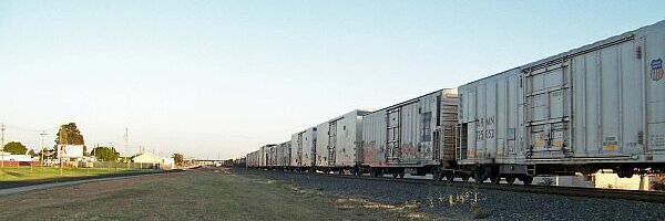
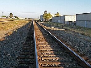
Union Pacific railroad track and Tidewater Bikeway 100ft left of the track
(Picture taken from a safe location at a railroad crossing)
The last mile of the bikeway runs parallel to the railroad in a safe, 100 feet distance.
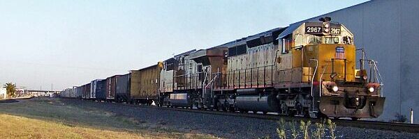
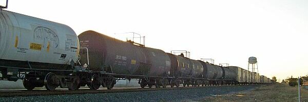
We walk the trail every day it never takes longer than half an hour until one of the giant Union Pacific freight trains with three engines and more than 100 wagons passes by.
|
 |
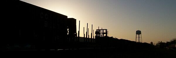
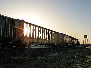
In the evening, under the right conditions, this part of the bikeway turns into something really romantic. We just love to stand near the old water tower and watch the trains riding into the sunset.
|
What Best Describes This Location: Mainline

Is this rail location handicap accessible?: paved trail, perfect for handicap access
Other Describe: Not listed
If there is a fee how much?: Not Listed
Related website: Not listed
|
Visit Instructions:
When logging a visit please include your own pictures and details of your experience. Pictures of rail activity in action are greatly encouraged and appreciated!
Try to provide the time of day you visited and how much activity you witnessed.
By providing times and activity in your details, the next visitor might have a better idea of when to make their visit.
Keep this in mind when you visit an Active Rail Locations waymark, the railroad determines how much activity there is on any given day.
Thank You!
Recent Visits/Logs:
| There are no logs for this waymark yet. |
|
|
|
|