
Cherokee Trail Roadside Park - Farmington, Missouri
Posted by:  BruceS
N 37° 46.738 W 090° 24.929
15S E 727612 N 4184437
Park dedicated to the Cherokee Trail (Trail of Tears) located on east side of Farmington, Missouri.
Waymark Code: WM3VAF
Location: Missouri, United States
Date Posted: 05/20/2008
Views: 70
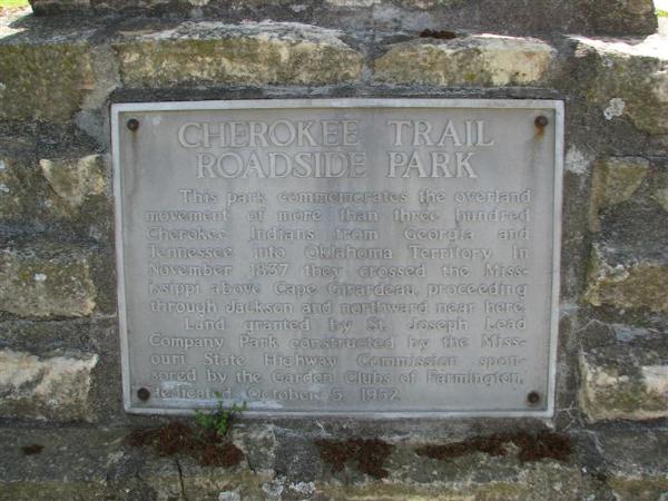
Cherokee Trail
Roadside Park
This park commemorates the overland movement of more than three hundred
Cherokee Indians from Georgia and Tennessee into Oklahoma Territory. In
November 1937 they crossed the Mississippi above Cape Girardeau proceeding
through Jackson and northward near here.
Land granted by St. Joseph Lead Company. Park constructed by the Missouri
State Highway Commission sponsored by the Garden Clubs of Farmington, dedicated
October 5, 1952.