
Pioneer Church - 66
Posted by:  Rose Red
N 42° 19.048 W 111° 18.007
12T E 475268 N 4685068
According to the marker, the Pioneer Church was located 1/2 block east and 1/2 block north in the spring of 1864. The church was also used for school and community center.
Waymark Code: WM315Y
Location: Idaho, United States
Date Posted: 01/23/2008
Views: 33
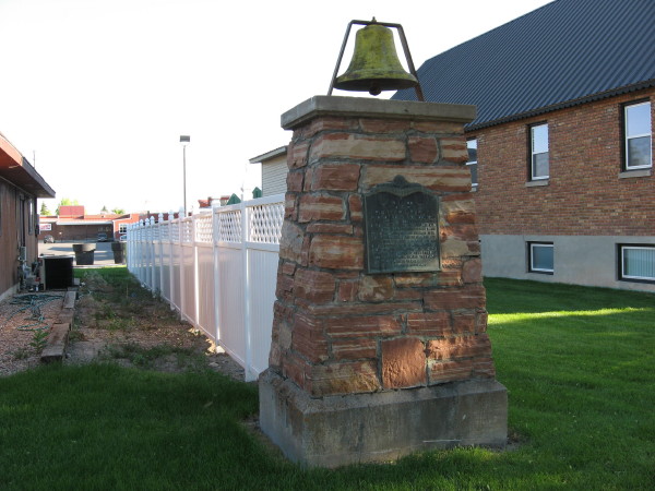
I traveled The Oregon Trail with an Elderhostel group from Kansas City/Independence, Missouri to Oregon City, Oregon June 13-28, 2007. On Friday, June 22, we traveled to Montpelier, Idaho.After settling in our motel, I walked into town where I photographed and got coordinates for the Pioneer Church marker and bell. The Pioneer Church, built of logs, was located 1/2 block east and 1/2 block north. The church was also used for school and community center. The bell called people together for many years.
I found the benchmark (NT0198) in the concrete base of World War Memorial in front of City Hall at Washington and Sixth Streets. I got a vanilla ice cream cone that was so cold it hurt to eat it. I took several more photographs and coordinates for waymarks.