County Named, 1838 - Carter County, Grayson KY
Posted by: Groundspeak Premium Member silverquill
N 38° 19.987 W 082° 57.110
17S E 329404 N 4244578
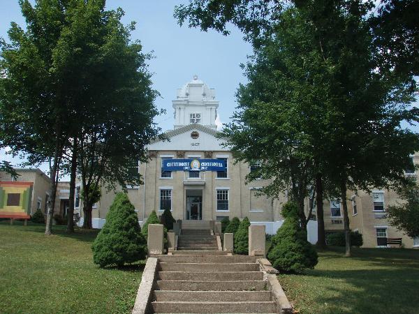
This marker is located on the lawn of the Carter County Courthouse Route 60, in the town of Grayson, Kentucky.
Waymark Code: WM2BNK
Location: Kentucky, United States
Date Posted: 10/07/2007
Published By:Groundspeak Premium Member snfromky
Views: 41


For Col. William Grayson Carter, state senator, 1834-1838. The 88th Ky. county formed, 32nd in area, Carter was created from Greenup and Lawrence. Noted in early years for 5 iron furnaces, its clay products industry developed in late 1800's. Carter Caves, a major source of saltpeter during War of 1812, has been important tourist attraction since 1924.
Marker Name: County Named, 1838

Marker Location: City

Type of Marker: Other

Marker Number (for official markers): 1247

Group(s) Responsible for placing Marker:
Kentucky Historical Society Kentucky Department of Highways


Visit Instructions:
A picture of the site or anything specific to the text on marker.
Search for...
Geocaching.com Google Map
Google Maps
MapQuest
Bing Maps
Nearest Waymarks
Nearest Kentucky Historical Markers
Nearest Geocaches
Create a scavenger hunt using this waymark as the center point
Recent Visits/Logs:
Date Logged Log User Rating  
Don.Morfe visited County Named, 1838  -  Carter County, Grayson KY 09/18/2022 Don.Morfe visited it