
Loring's Hill - GHM 060-69 - Fulton Co., GA
Posted by:  Lat34North
N 33° 47.666 W 084° 24.377
16S E 740131 N 3742387
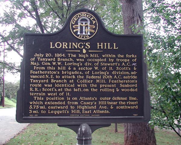
July 20, 1864. The high hill, within the forks of Tanyard Branch, was occupied by troops of Maj. Gen. W.W. Loring’s Div. of Stewart’s A.C. [Confederate].
Waymark Code: WM2BF9
Location: Georgia, United States
Date Posted: 10/07/2007
Views: 23
July 20, 1864. The high hill, within the forks of Tanyard Branch, was occupied by troops of Maj. Gen. W.W. Loring’s Div. of Stewart’s A.C. [Confederate].
From this hill & a sector W. of it, Scott’s & Featherston’s brigades, of Loring’s division, advanced N.E. to attack the Federal 20th A.C. astride Tanyard Branch at Collier Mill. Featherston’s route was identical with the present Seaboard R.R.: Scott’s at the left, on the rollomg & wooded terrain west of it.
This position is on Atlanta’s outer defense line, which extender from Casey’s Hill (near the river) 5.75 mi. eastward to Highland Ave. & southward 3 mi. to Leggett’s Hill, East Atlanta.
GHM 060-69 - Georgia Historical Commission - 1991
Located on the north side of Trabert Ave just east of Northside Dr.