
Moyie River Canyon - Boundary County, ID
Posted by:  T0SHEA
N 48° 43.631 W 116° 10.596
11U E 560553 N 5397455
This is a second historical marker at a pullout at the east end of the Moyie Canyon Bridge, telling travelers of the Moyie River Canyon and the bridges which have crossed it.
Waymark Code: WM180N6
Location: Idaho, United States
Date Posted: 05/04/2023
Views: 0
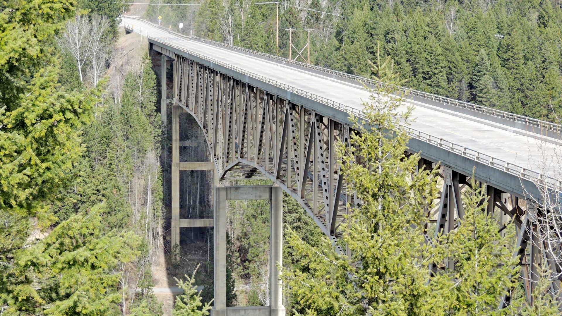
Spanning the Moyie River Canyon and the Moyie River below, the steepness and depth of the canyon necessitated a rather large bridge. Such wasn't the case 92 years ago in 1923 when the first bridge on this spot was built. It was built across the bottom of the canyon and required an extra 1¼ miles of twisting and turning narrow highway down into the canyon and back up the other side.
This is a cantilever truss bridge standing on tall reinforced concrete piers in the canyon and has steel girder approach spans on each end.
Coordinates given are at the roadside pullout on the east end of the bridge which affords a great view of not only the bridge but the Moyie River Dam north up the river from the highway. Also, there are some informative informational signs on the bridge, the canyon, the river and the dam at the pullout.
Transcribed from sign
Marker Name: Moyie River Canyon

Marker Type: Roadside
Marker Text:
See above
County: Boundary
City: Moyie Springs
Group Responsible for Placement: Idaho Department of Highways
Web link(s) for additional information:
https://historicbridges.org/bridges/browser/?bridgebrowser=idaho/moyieriverus2/
Date Dedicated: Not listed
Marker Number: Not listed
|
Visit Instructions:
In your log, please say if you learned something new, and if you took any extra time to explore the area once you stopped at the historic marker waymark.
If possible please post a photo of you OR your GPS at the marker location.
Also if you know of any additional links not already mentioned about this bit of Idaho history please include that in your log.
Recent Visits/Logs:
| There are no logs for this waymark yet. |
|
|
|