|
 Jim Bridger Lions Club Park - Bridger, MT Posted by:  T0SHEA T0SHEA
N 45° 17.459 W 108° 54.858
12T E 663550 N 5017392
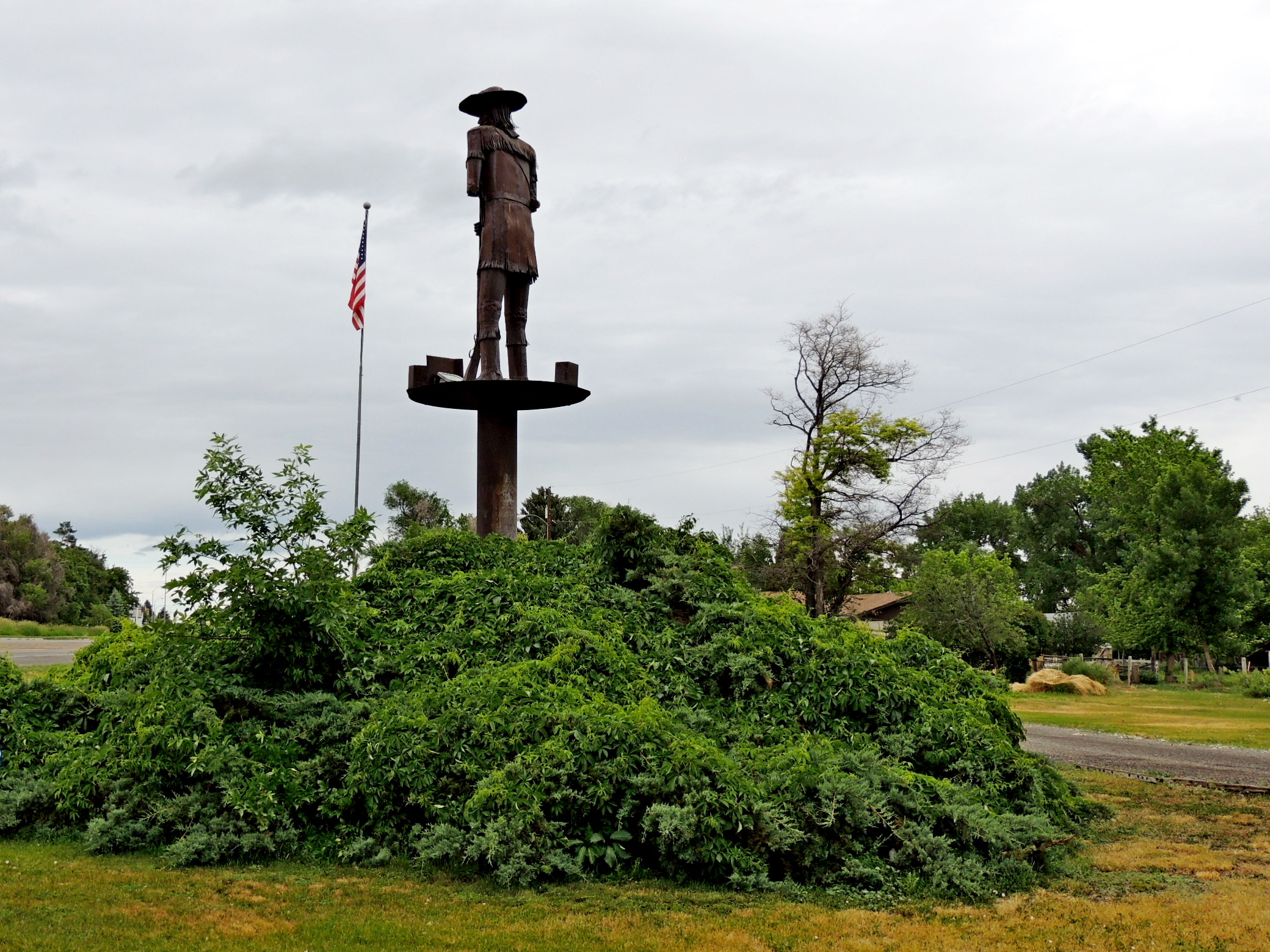
The town of Bridger was named after the subject of the State of Montana highway marker and the large sculpture in the park, explorer extraordinaire, Jim Bridger.
Waymark Code: WM15RJQ
Location: Montana, United States
Date Posted: 02/16/2022
Views: 5
On entering Bridger from the south on Highway 31, just about the first thing they will encounter is Jim Bridger Lions Club Park. It is a small, narrow park set between Highway 310 and South Main Street. In the park are a couple of covered picnic tables, a barbecue, an informational kiosk, a welded steel sculpture of Bridger, standing high atop a steep pole, and the highway marker whose text appears below.
JIM BRIDGER, MOUNTAIN MAN
Jim Bridger arrived in Montana in 1822 as a member of a Rocky Mountain Fur Co. brigade. He roamed the entire Rocky Mountain region and often came through this part of the country. A keen observer, a natural geographer and with years of experience amongst the Indians, he became invaluable as a guide and scout for wagon trains and Federal troops following the opening of the Oregon Trail.
He shares honors with John Colter for first discoveries in the Yellowstone Park country. He was prone to elaborate a trifle for the benefit of pilgrims. It was Bridger who embroidered his story of the petrified forest by asserting that he had seen "a peetrified bird sitting in a peetrified tree, singing a peetrified song".
The Clarks Fork of the Yellowstone was named for Capt. Wm. Clark of the Lewis and Clark Expedition. Chief Joseph led his band of Nez Perce Indians down this river when he made his famous retreat in the summer of 1877.
From the Highway Marker in the park
| |
JIM BRIDGER, MOUNTAIN MAN | Visit Instructions:
If you choose to visit a Lucky 7, please include a picture of the target of your favorite Waymark in the grouping. Include yourself in the picture if possible.
Recent Visits/Logs:
| There are no logs for this waymark yet. |
|
|
|
|