|
 Former Queest Mountain Lookout - Salmon Arm, BC Posted by:  T0SHEA T0SHEA
N 50° 42.266 W 119° 13.988
11U E 342316 N 5619336
RJ Haney Heritage Village & Museum is located at the southeast corner of the city of Salmon Arm. on Highway 97B/50th Street NE. It is about 1 km south of the Trans Canada Highway/Highway 1.
Waymark Code: WM151RF
Location: British Columbia, Canada
Date Posted: 09/28/2021
Views: 1
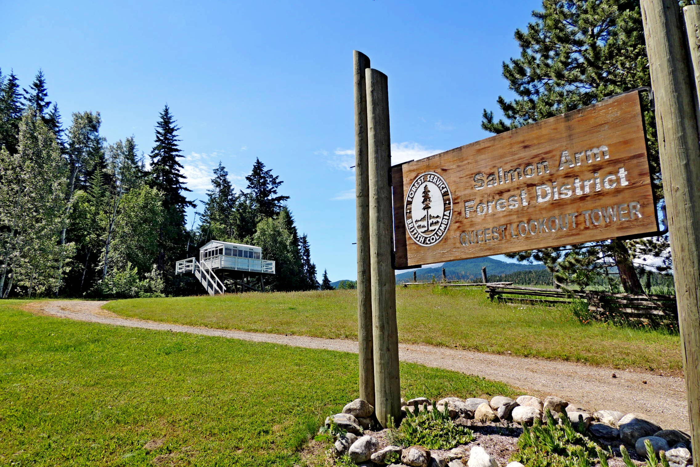
Directly south of the parking lot, at the west end of the village, is the Queest Mountain Lookout, from Queest Mountain on Anstey Arm of Shuswap Lake. Queest Mountain is about 40 km. northeast of the tower's present location.
This lookout station was used by the BC Forestry Service to monitor for forest fires in the Shuswap Region. It was moved from the mountain to Haney Heritage Village by helicopter in 2005. An old photo taken while the tower was still on Queest Mountain tells us that the tower was no higher above ground then as it is now.
The Queest Mountains have become the Shuswap’s best-known, free snow playground, with sledders to the northwest and skiers and boarders to the southeast. It was George Mercer Dawson who named these mountains and the creek, deriving the word Queest from the word, Kwieshp that was used in his 1877 Canadian Geological survey. An early translation of the word was ‘buffalo,’ but this translation was later deemed incorrect, and the original derivation of the name remains a mystery.
From Shuswap
Queest Lookout Tower
A lookout station from Queest Mountain on Anstey Arm tells the story of forestry protection in the Shuswap. The tower was helicoptered off the mountain, relocated, and refurbished by the Salmon Arm Forest District staff in 2005.
From the Salmon Arm Museum
Within the museum grounds is the Broadview School, a one room schoolhouse constructed in the winter of 1917. It was moved to the village in 1988. Also on the grounds are the R.J. Haney House from around 1910, Mt. Ida Church, Blacksmith Shop, Filling Station with old pumps in front, a Cook’s House, circa 1900, the Kew Homestead, circa 1890s, one of the first log homes built in the valley, and the Queest Lookout Tower. All of these buildings have displays within them.
Accompanying the buildings is an assortment of vehicles, tractors, farm implements and other cool old mechanical paraphernalia.
Original Location: N 51° 00.442 W 118° 56.075

How it was moved: Other
Type of move: City to City
Building Status: Public
Related Website: [Web Link]
|
Visit Instructions:
Tell of your visit. Post an original photograph if possible.
Recent Visits/Logs:
| There are no logs for this waymark yet. |
|
|
|
|