
HEPC of Ontario Survey Marker - Burk's Falls, ON
Posted by:  13acres
N 45° 37.728 W 079° 24.336
17T E 624280 N 5054042
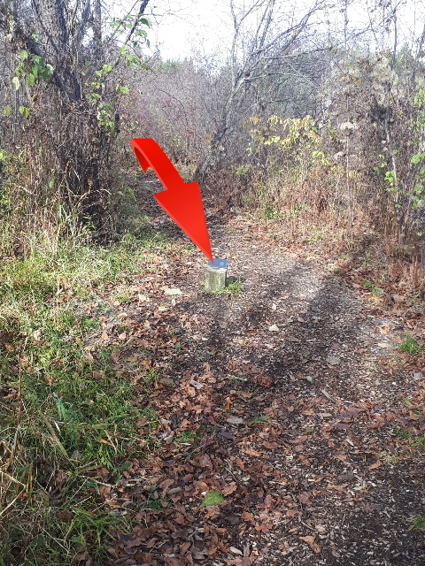
A survey marker set in a concrete post along the Riverside Path hiking trail
Waymark Code: WM14YGH
Location: Ontario, Canada
Date Posted: 09/12/2021
Views: 1
While out hiking on the Heritage River Trails we decided to take the River Path back and came across this bronze survey disk set right in the middle of the trail. After researching, we found it to be a Hydro Electric Power Commission of Ontario survey marker from 1950. The stamped year coincides with the year that the Burk’s Falls generation station was acquired by Ontario Hydro and the municipality connected to the provincial hydro system. When the monument is plotted on a topographical map with land parcel data, it falls within meters of the intersection of lot 6 concession 9/10 in the township of Armour and the bank of the Magnetawan River.
Access
To access the disk, make your way to the Welcome Centre in the village of Burk's Falls, Ontario. Parking can be found at N45° 37.185 W079° 24.720. Enjoy a short 1.3 km hike to the monument along the Heritage River Trail. Near the end of the trail, keep left at the Trestle Trail and then left again at the Riverside Path. From this intersection it is about 100 m to the monument at N45° 37.728 W079° 24.336.