I was headed up British Columbia's Highway 33, which runs from Rock Creek to Kelowna, in search of a few Waymarks in the vicinity of Rhone, once a railway siding and a flag stop on the Kettle Valley Railway (KVR) from August 29, 1915 to January 17, 1964. About 18 kilometres north of Rock Creek I turned west onto the old Blythe-Rhone road, which parallels Highway 33 for about 8 kilometres, passing through the community of Rhone.
About 225 metres after turning onto the Blythe-Rhone road I encountered a small but heavily built one lane bridge over the Kettle River. There was something amiss with this bridge and I immediately realized, from its overly robust construction, that it must have been a railroad bridge in its former life.
The KVR, then owned by the Canadian Pacific Railway (CPR), was built from Midway, Mile"0", to Hope in the years 1910 to 1915, with the first passenger train passing through Rhone on August 29, 1915. Passenger service was discontinued here January 17, 1964, but the line remained in operation until the CPR, after a decade of failure, finally convinced the government to allow it to abandon the line, officially abandoning it on December 22, 1978. Tracks in this section were lifted in 1979.
After taking a large handful of photos I continued up the road to my next destination, the Fillmore Family Farm, about 1.5 kilometres further up the road.
There I encountered two members of the Fillmore Family, the elder of which recounted how he had, immediately after the tracks had been removed by the CPR, with a D8 Caterpillar, pulled the bridge I had just driven over from its seats onto the ground beside the river. It had then been loaded onto a multi-axle tractor trailer and hauled the 6 kilometres or so south to its present location and, with the help of several community members and some heavy machinery, it was then set in place on newly placed steel footings. That same individual had previously been instrumental in earlier removing the wooden bridge which this bridge replaced.
This bridge was not the original one to occupy its spot on the KVR. The first bridge, a wooden Howe truss span, built in place in about 1910 or 1911, was replaced by this Pony Truss Bridge in 1929.
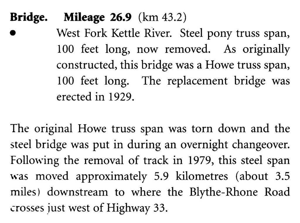
The following excerpt is from Page 1-17 of the book "
Kettle Valley Railway Mileboards",
ISBN: 0-9696971-2-0.
The mileage referred to is from Midway, Mile "0" on the KVR.