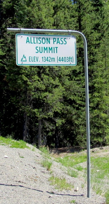
 Allison Pass Summit
Elevation
1342 meters
4403 feet
Allison Pass Summit is the highest point of the Hope-Princeton Highway, the westernmost section of the Crowsnest Highway that continues to Medicine Hat, Alberta, crossing the Continental Divide at the border between British Columbia and Alberta. It was opened in 1949.
"Cyclists and motorists alike find this stretch of road difficult because of the steep grades and high altitudes. On the way from Hope to Allison Pass, one must ascend the 7% (1 in 14) grades up to the Hope Slide before one can start up to Allison Pass, leaving many trucks waiting at the side of the road for their engines to cool down."
From Wiki
The pass was named after John Fall Allison, a rancher living in Princeton. He was born on January 6, 1827 in Leeds, Metropolitan Borough of Leeds, West Yorkshire, England and passed away on October 28, 1897 at the age of 70 years of age in Princeton. John is at rest in the Allison Family Cemetery with his parents, wife and children. In total there are 65 family interments.