79C668 - Avola, BC
Posted by:  T0SHEA
N 51° 47.145 W 119° 19.302
11U E 339863 N 5739758
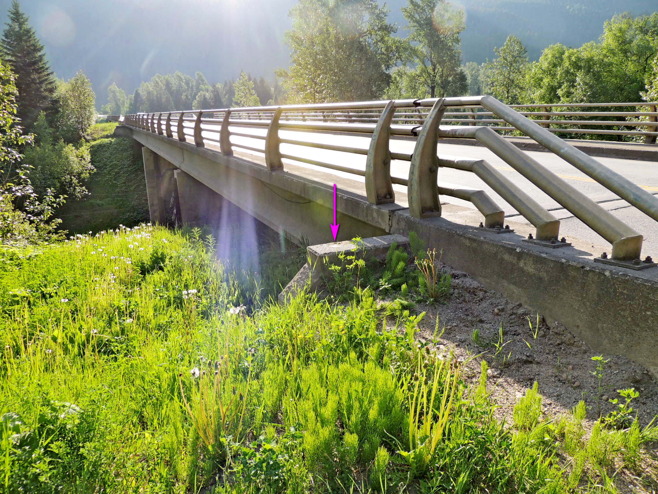
79C668 is on another of the several crossings of the North Thompson River by the Yellowhead Highway, this one at the northern edge of the Village of Avola.
Waymark Code: WM1182K
Location: British Columbia, Canada
Date Posted: 09/03/2019
Views: 1
This is another of the bigger bridges one will cross on their journey up or down the Yellowhead as it crosses both the river and the Canadian National tracks, both at an angle. The result is a 250 metre, 800 foot, bridge.
79C668 is monumented on the bridge, in the top of the northeast bridge abutment at the southeast corner of the bridge.
NRCAN has the location wrong, indicating it to be in the face of the abutment, not the top.
Name	Province 		NTS map sheet	Unique Number
79C668	British Columbia	082M14		79C668
Blue_river
Bridge over the north thompson river and c.n.r. Along highway no. 5, 12.0 km southwesterly of bridge over blue river in town, 10.4 km north of the messiter summit viewpoint, 1.6 km south of peddie mountain road, 0.6 km south of a point where a b.c. Hydro transmission line crosses highway, tablet in north face of the northeast abutment at the southwest end of the bridge, approximately 50 cm below the top.
From NRCAN