|
 Rancho San Antonio, San Leandro, Ca Posted by:  WalruZ WalruZ
N 37° 43.630 W 122° 09.475
10S E 574206 N 4175878
The Southern boundary of a land grant than stretched to Albany
Waymark Code: WM1068
Location: California, United States
Date Posted: 11/28/2006
Views: 18
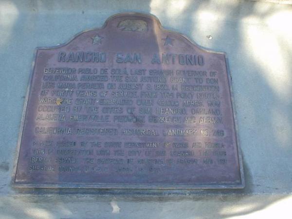
Governor Pablo de Sola, last Spanish governor of California, recognized the forty years' service of Don Luís María Peralta by awarding him the 43,000-acre San Antonio Grant on August 3, 1820. From this point northward, the grant embraced the sites of the cities of San Leandro, Oakland, Alameda, Emeryville, Piedmont, Berkeley, and Albany.
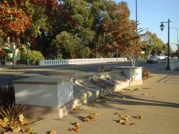
Today the marker sits in Root Park, hard against East 14th street, barely noticed by passing pedestrians. Imagine - from the bay to the hilltops, and from here to Richmond. That's a lot of land, and once yankees started moving in those huge ranchos proved vulnerable to squatting and subdivision.
Marker Number: 246.00

Marker Name: RANCHO SAN ANTONIO (PERALTA GRANT)
County: Alameda
Has Official CA Plaque: yes
Marker Dedication Date: 03/14/1970
Location:
In city park at NW corner of E 14th and Hays Sts, San Leandro (southern boundary of rancho)
Website: Not listed
|
Visit Instructions:
Feel free to post a picture of you at the landmark site, but a photo is not required to log a visit.
|