Monterey Peninsula, California
Posted by: Groundspeak Regular Member Bernd das Brot Team
N 36° 36.718 W 121° 51.511
10S E 602080 N 4052434
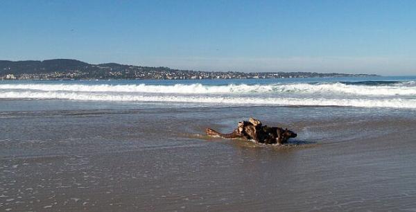
N 36° 36.678 W 121° 51.471 Monterey, seen from neighboring Seaside
Waymark Code: WM1276
Location: California, United States
Date Posted: 12/22/2006
Published By:Groundspeak Regular Member silverquill
Views: 33

How does one take a picture of a town that is built along the shore around a peninsula? The best way would be to use a ship or a helicopter, and there is a really cool website that did just that.

The other way is to find a beach a little bit further away and try not to get one’s feet wet. As it turned out, I had to go to Seaside, to take a picture of Monterey, but that is ok, after all, I took Seaside’s picture from a hill in Monterey.

Again, not much of a skyline, but still a great view at any weather.


I put a panorama together, and tried to upload it in full size, but groundspeak downsized it. So I placed it somewhere else. Click on the thumbnail to get the picture.

City Name: Monterey

View Type: Over Water

Location Type: Other

City Lights: yes

Terrain:

Distance: Not listed

Fee: Not Listed

Visit Instructions:
Logging requirements are left to the waymark owner, but a photo is always appreciated.
Search for...
Geocaching.com Google Map
Google Maps
MapQuest
Bing Maps
Nearest Waymarks
Nearest Cityscapes
Nearest Geocaches
Create a scavenger hunt using this waymark as the center point
Recent Visits/Logs:
Date Logged Log User Rating  
manahoonie visited Monterey Peninsula, California 09/21/2022 manahoonie visited it
Castor007 visited Monterey Peninsula, California 02/03/2019 Castor007 visited it
macdod visited Monterey Peninsula, California 10/05/2011 macdod visited it
hotshoe visited Monterey Peninsula, California 09/28/2008 hotshoe visited it

View all visits/logs