FAA Identifier: 5R4
Elevation: 74 ft. / 23 m (estimated)
Variation: 01E (1985)
Airport use: Open to the public
Sectional chart: NEW ORLEANS
Control tower: no
ARTCC: JACKSONVILLE CENTER
FSS: ANNISTON FLIGHT SERVICE STATION [1-866-609-8684]
NOTAMs facility: ANB (NOTAM-D service available)
Attendance: MAR-OCT 0700-2000, NOV-FEB 0700-1900
Wind indicator: lighted
Segmented circle: yes
Lights: DUSK-DAWN
Beacon: white-green (lighted land airport)
Fuel available: 100LL
Parking: tiedowns
Airframe service: MAJOR
Powerplant service: MAJOR
Bottled oxygen: NONE
Bulk oxygen: NONE
Runway Information
Runway 18/36
Dimensions: 3700 x 75 ft. / 1128 x 23 m
Surface: asphalt, in good condition
Weight limitations: Single wheel: 28000 lbs
Runway edge lights: medium intensity
RUNWAY 18 RUNWAY 36
Latitude: 30-25.958667N 30-25.348333N
Longitude: 087-42.049167W 087-42.049167W
Elevation: 62.9 ft. 74.4 ft.
Traffic pattern: left left
Runway heading: 179 magnetic, 180 true 359 magnetic, 360 true
Markings: basic, in good condition basic, in good condition
Visual slope indicator: pulsating/steady burning VASI on left pulsating/steady burning VASI on left
Touchdown point: yes, no lights yes, no lights
Obstructions: 24 ft. tree, 1150 ft. from runway, 190 ft. right of centerline, 39:1 slope to clear 14 ft. road, 451 ft. from runway, 17:1 slope to clear
Airport Operational Statistics
Aircraft based on the field: 35
Single engine airplanes: 30
Multi engine airplanes: 2
Helicopters: 2
Ultralights: 1
Aircraft operations: avg 68/day
67% transient general aviation
33% local general aviation
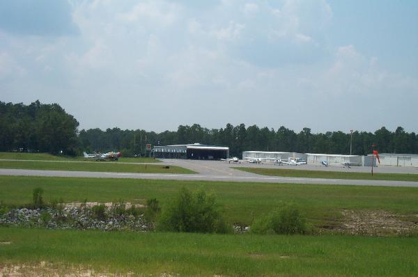
Personal note: There are city streets/county highways on both ends of the runway.
If you ever want to get a picture of a low flying plane, this would be a good place to try.
I've parked at the south end for a while but never had the time to wait for a plane to fly by.
To log this waymark you must include at least two photos of identifiable features of the airport one being sign that identifies the airport.
To do this you just fill out the form and comments and submit log. On the next page click on View Log.
Now on the right side you have an option to upload an image for this log.
Upload your pictures and they will appear properly.
LOGS WITHOUT PICTURES WILL BE DELETED!!!
You can log this airport only once. Duplicate logs will be deleted.
There are a couple of other local airports you can log: