
Fort Peck Project- Fort Peck, Montana
Posted by:  Bon Echo
N 48° 00.498 W 106° 24.018
13U E 395561 N 5318171
According to the sign, the Fort Peck Project was "the single largest employer of the New Deal"
Waymark Code: WMZ6CY
Location: Montana, United States
Date Posted: 09/17/2018
Views: 1

Located along the mighty Missouri River in northeastern Montana, the Fort Peck Project saw the creation of the Fort Peck Dam, spillway, two powerhouses, and several other structures. Also of historical interest are the many temporary and permanent "supporting" infrastructure projects associated with the dams construction, including the building of roadways, railways, towns, power-transmission corridors, and even a shipyard!
The Fort Peck Dam is the largest hydraulically filled dam in the United States. The dam is just over twenty-one-thousand feet long and over two-hundred and fifty feet high. Constructed between 1936 and 1940 under the New Deal, this was one of the largest projects at least in terms of the number of people employed. While the project had a profound geological impacts (by creating Fort Peck Lake, the fifth-largest man-made lake in the USA, having a longer shoreline than does the state of California), the Fort Peck Project also had a profound geographical impact on the surrounding area, as several towns sprang up in order to support the thousands of workers and the many more that were indirectly employed during the dam's construction:
When President Franklin D. Roosevelt authorized the Fort Peck project in 1933, thousands of Depression-bled people from all over the country migrated to Montana in hopes of earning a living.
More than 7,000 men and women signed on to work on the dam in 1934 and '35, during the midst of the Great Depression. Employment peaked at nearly 11,000 dam workers in 1939, and thousands more swarmed to Montana to set up businesses including food markets, hardware stores, butcher shops, general stores, saloons and brothels.
Eighteen boomtowns sprang up in the vicinity, and the "wild west" was reborn as a tiny and obscure township swelled from a population of a few hundred to nearly 40,000 people.
Source: Fort Peck Project - History (Web Archive)
There are several vantage points for viewing this massive dam and associated structures. The coordinates posted for this Waymark will bring you to an overlook just behind the dam, between the control gates and the powerhouses. There you will find a number of information signs, including one to denote the role of the WPA in the Fort Peck Project:
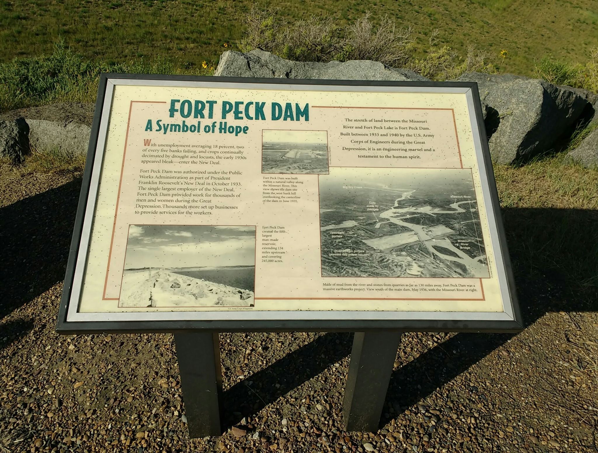 |
FORT PECK DAM
A SYMBOL OF HOPE
With unemployment averaging 18%, two of every five banks failing, and crops continually decimated by drought and locusts, the early 1930s appeared bleak - enter the New Deal.
Fort Peck Dam was authorized under the Public Works Administration as part of President Fraklin Roosevelt’s New Deal in October 1933. The single largest employer of the New Deal, Fort Peck Dam provided work for thousands of men and women during the Great Depression. Thousands more set up businesses to provide services for the workers |

Much of the 21,000'-long earth-filled dam is visible behind the signs in the above photo